Sometimes the best journeys begin with a last-minute change of plans. Ours certainly did. We had every intention of sailing to the British Virgin Islands, but a conversation with fellow sailors nudged us in a different direction. Whether the stories were exaggerated or not, the BVI’s reputation for crowded anchorages and scarce moorings gave us pause. Instead, we set our sights on the quieter, more laid-back charm of the U.S. Virgin Islands—particularly St. John, where much of the coastline is protected as part of the National Park system.
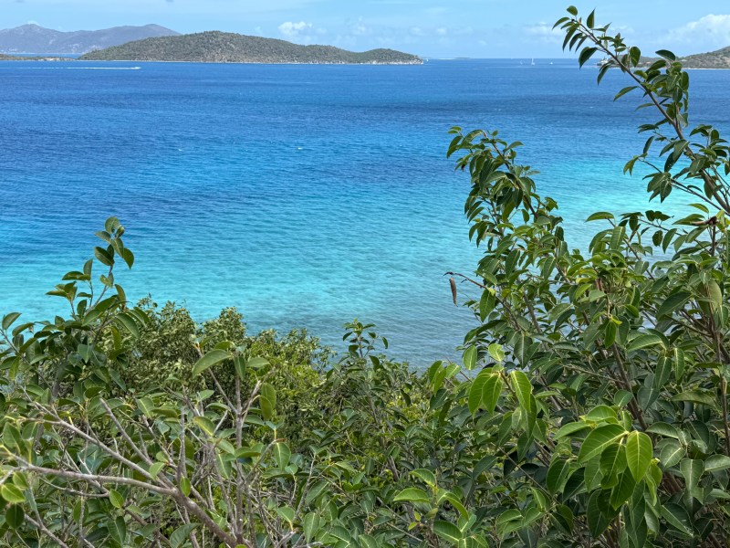
The overnight sail from St. Martin was an easy, mostly downwind passage. By morning, we slipped into a small, empty bay and dropped anchor, greeted by stillness and space. We spent the day soaking it all in: sunlight dancing on the water, a gentle breeze tracing ripples across the surface, and the occasional turtle lifting its head as if to welcome us. It was the perfect introduction to a place that already felt like the right choice
Coral Bay
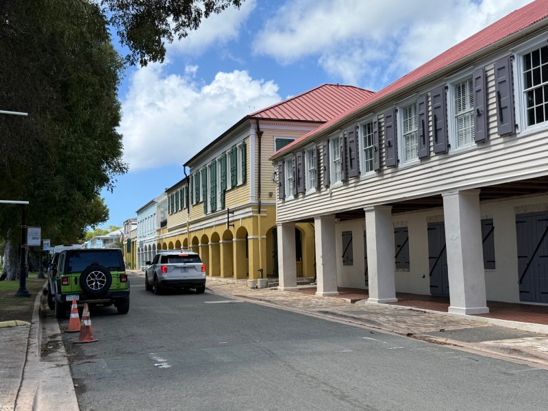
The next day, we made the short motor sail to Coral Bay, easing Jajabor into one of St. John’s livelier anchorages. We planned to stock up on provisions and set out on a hike to the island’s north shore. The bay was busy, boats scattered across the anchorage, but we found a spot to drop the hook and settle in.
As we stepped onto the dinghy dock, we spotted a ray gliding effortlessly through the mangroves just a few feet away, as if it had come to greet us.
Small sting ray at the dinghy dock
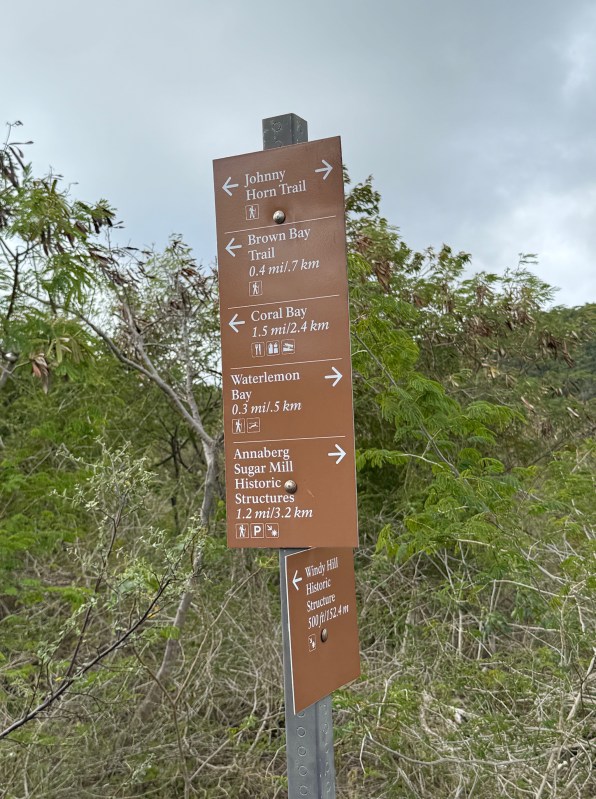
Johnny Horn Trail
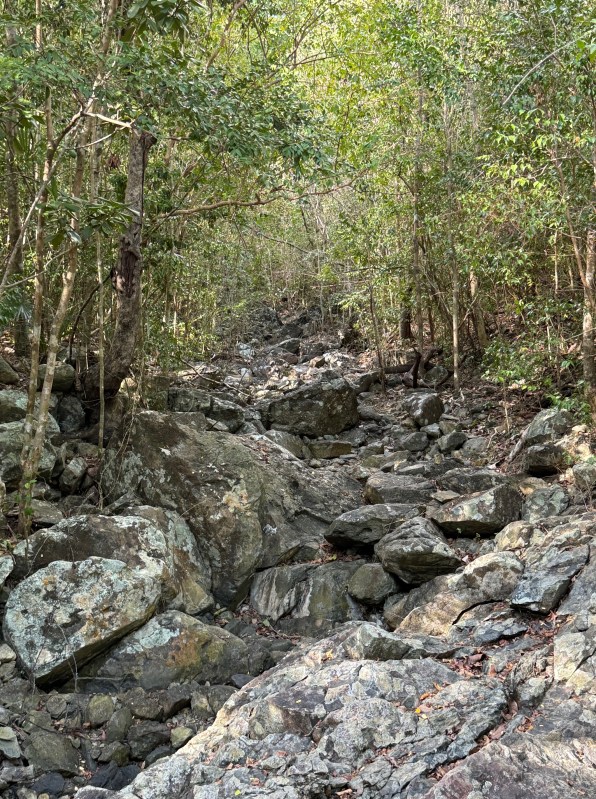
Our pick for a hike was a 3.3 mile out and back trail stretching from Coral Bay to Waterlemon Bay on the north side of St. John. It began with a steep, demanding climb, where sections of the trail were made up of large, uneven boulders that kept us focused on every step. We pushed on, slowly gaining elevation until we reached the highest point, where the trail began to ease and roll into a gentler descent toward Waterlemon Bay.
Along the way we caught breathtaking glimpses of Brown Bay and Waterlemon Bay opening up through the trees, flashes of blue that stopped us in our tracks. Side trails branched off, leading to the quiet remains of old sugar plantation ruins, subtle reminders of the island’s layered history.
By the time we made our way back to Coral Bay, tired and salt-streaked, we had only one thing on our minds. We rewarded ourselves with cold, refreshing smoothies from Dazey’s Bayhouse Café—a well-earned treat and the perfect ending to the day.
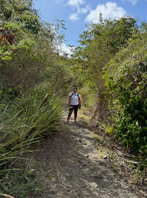
Plenty of Side trails branch off the Johnny Horn Trail.
Waterlemon cay
Unknown ruins above Waterlemon Bay
Hansen Bay
Coral Bay, for all its charm, proved to be an uncomfortable anchorage. The swell seemed to build as it rolled toward shore, rocking the boat in ways that made even simple tasks feel harder than they should. After a restless stretch, we decided to move.
A short hop brought us to Hansen Bay, where the difference was immediate. The water lay calmer, better protected from the swell, and the entire anchorage felt more at ease. We dropped anchor just north of Pelican Rock—aptly named, it seemed, for the steady lineup of pelicans perched along its top.
Mask and snorkel in hand, I slipped into the water to check on the anchor. What I found below was a mix of wonder and unease. Turtles drifted lazily through the blue, a giant ray passed silently beneath me, and clusters of squid hovered along the edge of the rocky cliff. It was the kind of underwater scene that makes you linger.
But scattered across the seafloor was a different story—twisted debris, remnants of wrecked boats, likely casualties of past storms and hurricanes. It was hard not to imagine the forces that left them there. As beautiful as the setting was, I couldn’t shake a quiet concern that our anchor chain might get caught on something below.
Pigeon rock in Hansen Bay is great for snorkeling
A friend comes to visit
We had something special to look forward to—our friend Micki was flying out to join us for a few days aboard Jajabor. To make things easier, we picked up a mooring in Francis Bay, a quiet, protected spot with relatively easy access to nearby Maho Beach. From there, we could catch a local bus to Cruz Bay and meet the ferry she would be traveling on from St. Thomas.
“Easy,” of course, is a relative term out here. There are no dinghy docks at either Francis or Maho Beach, which meant that after several long layovers, a grueling overnight flight, and a ferry ride, Micki’s final stretch would involve wading to the dinghy. Not exactly the typical airport pickup—but she was game.
We took the bus into Cruz Bay ahead of her arrival, making the most of the trip with a relaxed lunch, a stop at the local grocery store to stock up on provisions, and a wander through town that included the National Park Visitor Center. By the time we made our way to the ferry dock, the timing couldn’t have been better. The ferry pulled in right on schedule, and it wasn’t long before we spotted Micki stepping off—travel-worn, but smiling.
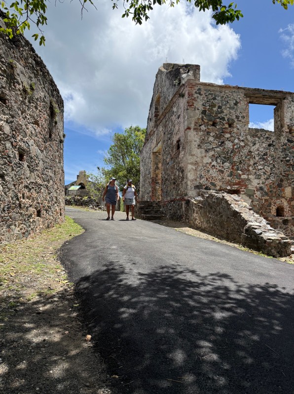
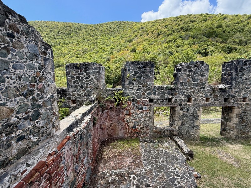
Annaberg Sugar Plantation
A short distance from Francis Bay lie the remnants of the Annaberg Sugar Plantation. Built in the 18th century, the site stands as a quiet reminder of a time when the island’s sugar industry was booming. The terraced hillsides are now thick with trees and brush, but it’s not hard to picture the landscape as it once was—orderly rows of cane, constant motion, and the hum of relentless labor driven by enslaved Africans.
According to the National Park Service, more than 600 enslaved people worked this plantation under harsh and unforgiving conditions. Today, the ruins feel still, almost contemplative, as if holding the weight of that history just beneath the surface.
During my visit, several busloads of local schoolchildren arrived, guided through the site by patient teachers whose firm voices carried across the stone remains. Watching them, I found myself wondering what the children made of this place. Did they feel the gravity of its past, or was it simply another outing—a break from routine, the deeper meaning only faintly registering, if at all?
Just across from the plantation is Waterlemon Bay. The next day, we set out on the Leinster Trail, an easy path that hugs the shoreline for about 0.8 miles. Along the way, a short spur branches off to the Johnny Horn Trail, but we stayed on Leinster, which also leads to Waterlemon Cay—a small island just offshore from the beach.
The walk itself is beautiful, with constant views of the water. Not surprisingly, the bay was full of life—while snorkeling, we spotted turtles gliding through the water, rays drifting along the sandy bottom, and even caught a glimpse of a shark cruising surprisingly close to shore.
Annaberg Sugar Plantation overlooks the sea’s brilliant Caribbean blue waters
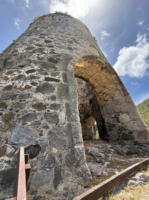
Remnants of the windmill used to crush the cane. There are hundreds of these in the virgin islands
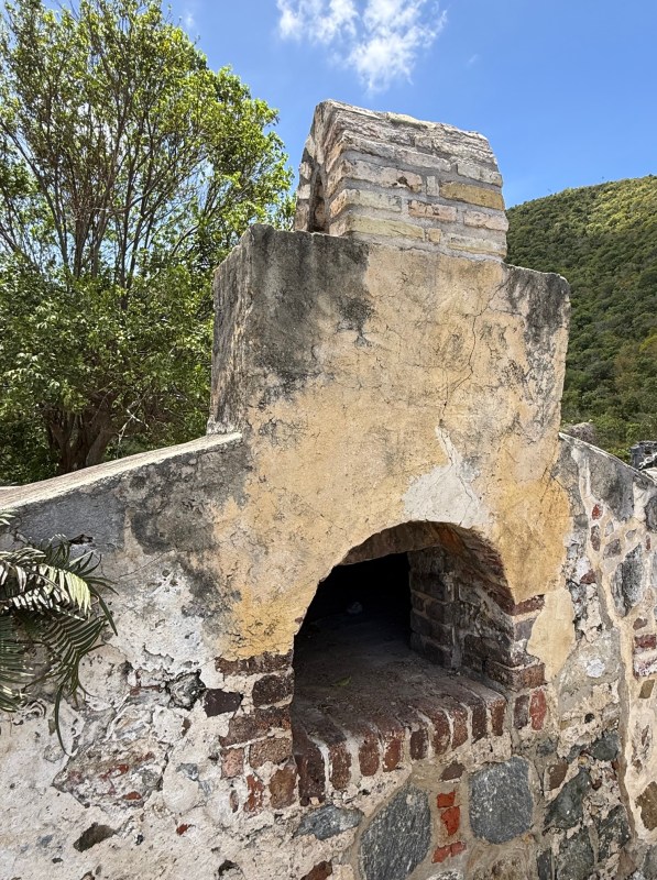
Coral rock was cut and shaped for use in the construction of plantation buildings and other structures.
Ruins of a once-thriving sugar factory where 300–500 gallons of cane juice were processed per hour. The brutal and dangerous work depended on the skill and forced labor of enslaved people, and the industry collapsed after slavery was abolished.
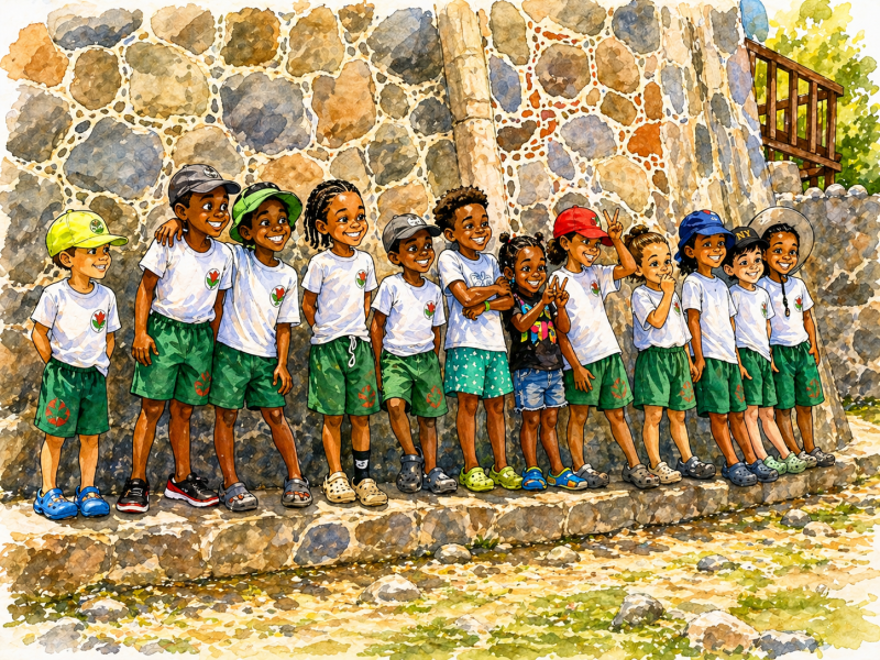
The pure joy of the children on their school trip was evident in their smiling faces. The teachers, on the other hand, were finding it challenging to corral the lively group
Salt Pond
Across from Francis Bay is small lagoon, a salt pond that is an excellent place for birdwatching. The trail starts near the parking lot at Francis Bay and loops around the pond. It passes several historic ruins including Mary Point Great House. A boardwalk along one side of the pond, opens up at viewing platforms where you can observe life on and around the salt pond.
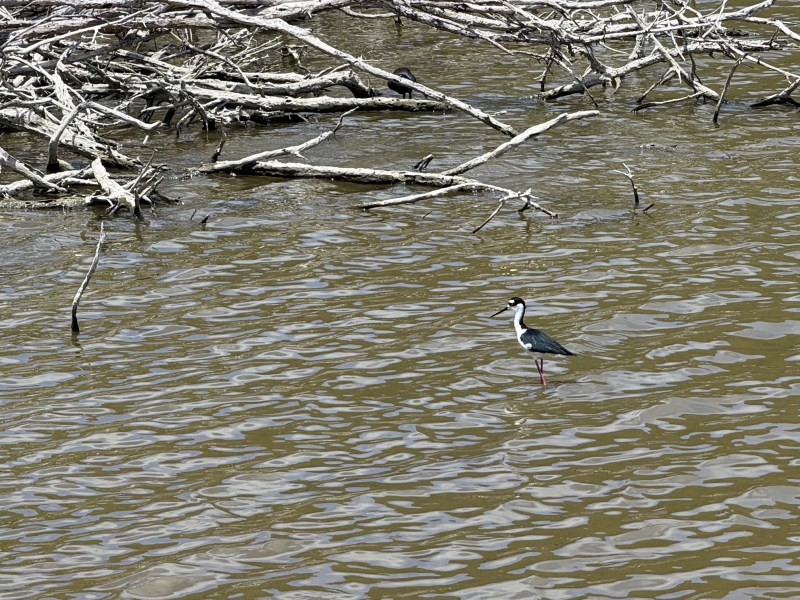
Amazing variety of birds in these salty lagoons
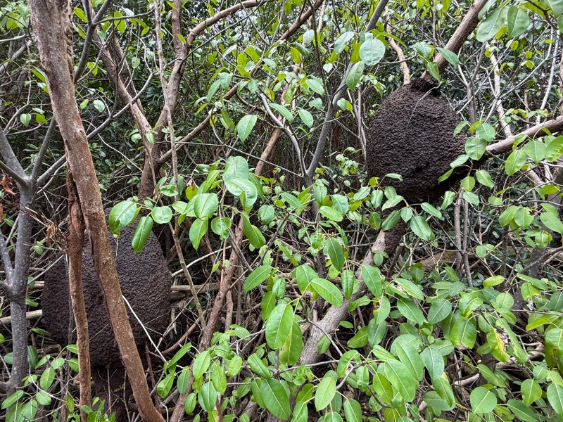
Termite mounds on the trees all around the salt pond
A squall
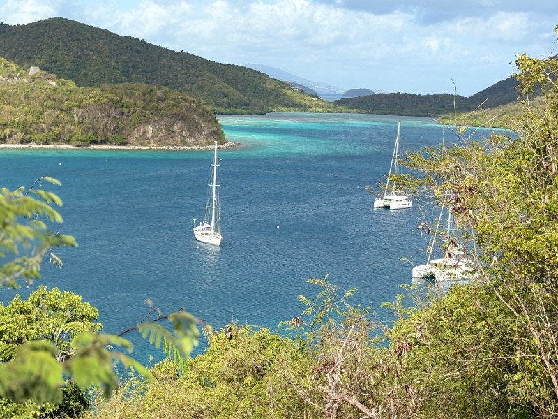
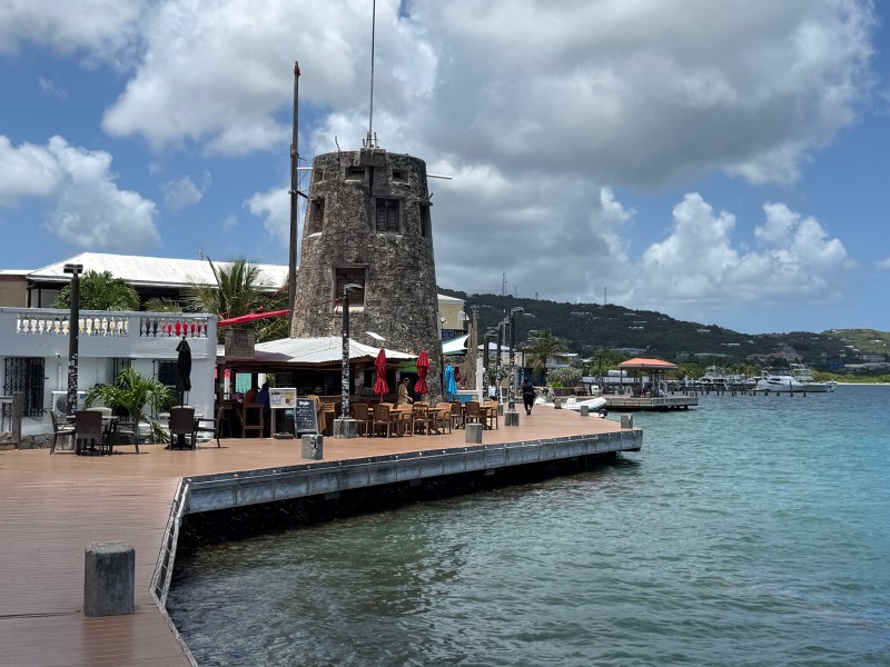
Soon it was time to say goodbye to St. John and make our way to neighboring St. Thomas. Our plan was to anchor at Christmas Cove—a sheltered bay off Great Saint James Island, just across the way.
We rounded Ram’s Head and had barely raised our sails when the sky began to darken, hinting at what was coming. Thunder rumbled in the distance as clouds gathered quickly, and before long we were caught in a heavy squall. With the sails up, we surged forward, rain pelting down as the wind carried us swiftly toward St. Thomas. A thick mist closed in, cutting visibility to barely a hundred yards. Over the VHF radio, nearby boats called out their positions, their voices adding to the tension of the moment.
Through it all, our friend Micki remained impressively calm—a steady presence in an otherwise unsettling situation. The rain showed no sign of letting up, and as we approached the entrance to Christmas Cove, visibility was still too poor to safely make the turn. We decided it was best to press on and look for a safer anchorage farther west.
Shortly afterwards, the rain began to ease, giving us a chance to lower the sails and slow Jajabor. As visibility improved, we turned into the harbor at Hansen Point and dropped anchor, finally able to relax. We were completely soaked, rain gear and all, but a hot instant cappuccino helped take the edge off—and before long, the sun began to peek through again.
St Thomas
Our time in St. Thomas was brief. Micki would soon be heading home, and we would head south for our final stop in the USVI—St. Croix. Still, we made the most of our stay, exploring the lively capital of Charlotte Amalie and nearby Water Island.
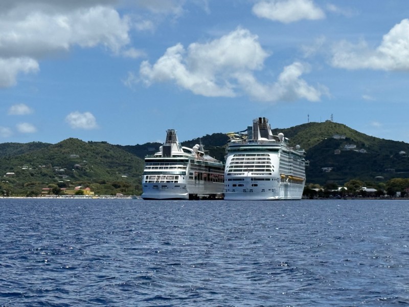
Cruise ships dock regularly in Charlotte Amalie and Crown Bay, and when they do, the town comes alive. Thousands of passengers spill into the streets, filling the shops, restaurants, and historic sites with energy and movement.
A short dinghy ride took us to Waypoints Marina, where we tied up, followed by a quick bus ride into town. The harbor itself is constantly in motion, with ferries coming and going to destinations across the USVI, BVI, and even Puerto Rico. Seaplanes skim across the water, taking off and landing at regular intervals, adding to the steady rhythm of activity.
Exploring Fort Christian, and a stop at the offices of the Historic Trust gave us some insight into the towns past, and events that have shaped its present. The staff at the Historic Trust are friendly and generous with their time, willing to answer our questions in great detail. Several 20th and 21st century hurricanes devastated the islands, with Irma and Maria striking a one-two punch in 2017. This has tested the resilience of the islanders and recovery has been slow but intentional, with stronger construction.
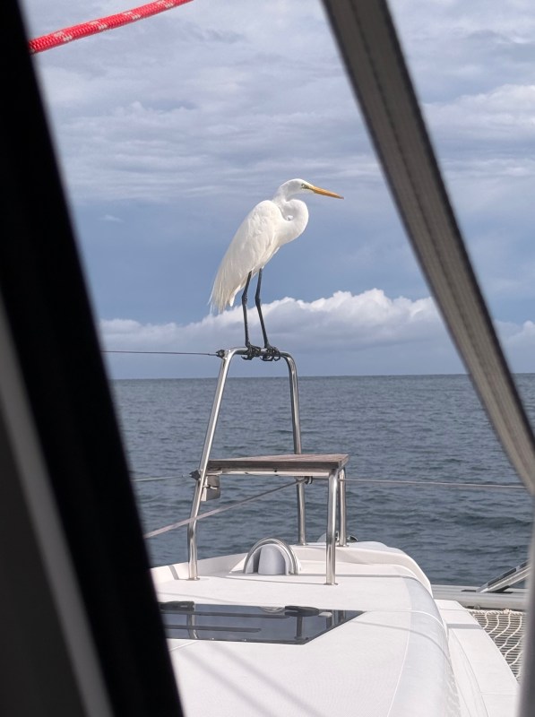
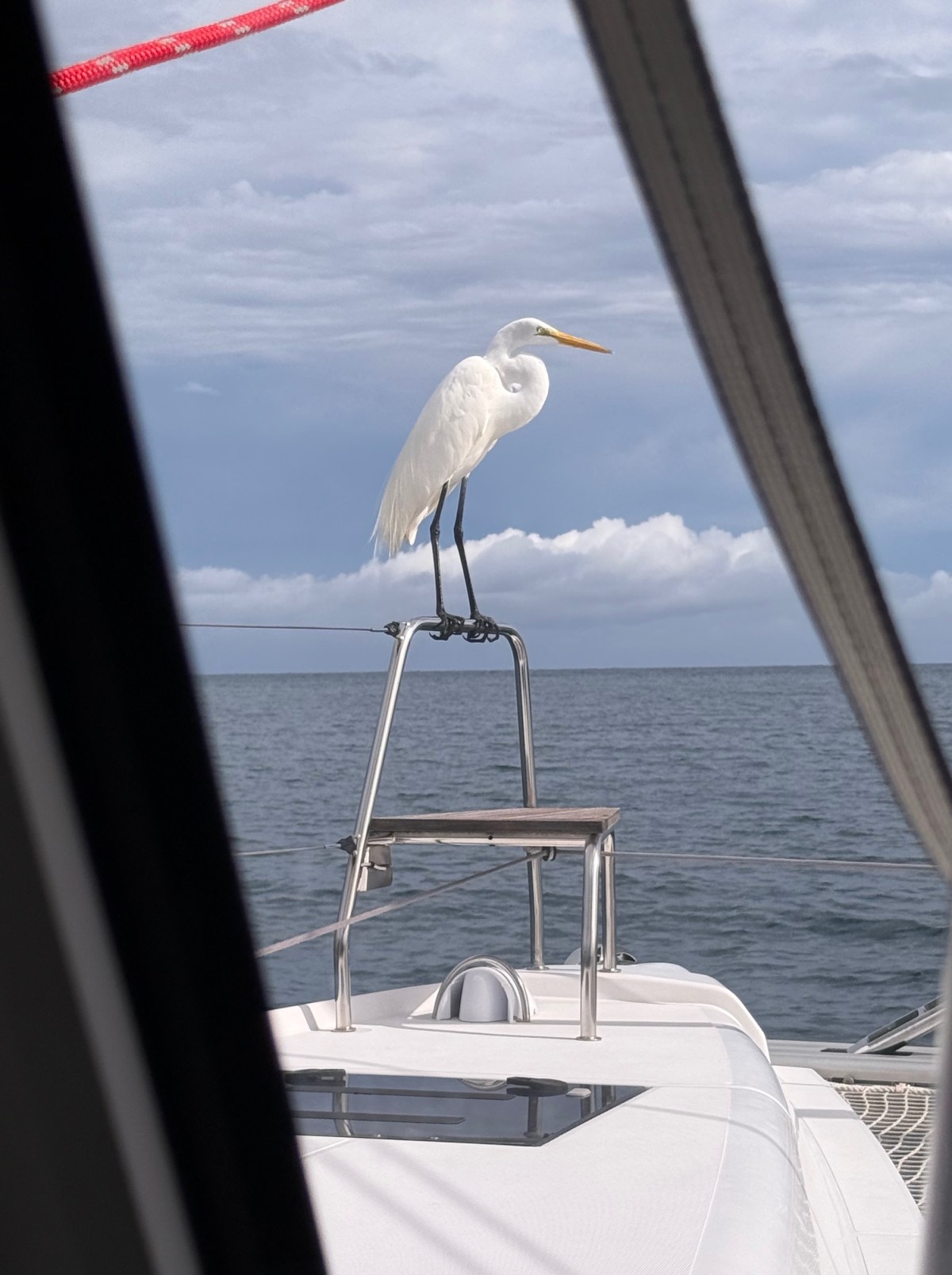
Gigi the Great Egret found our boat to be a better perch for fishing.
Barry the shy barracuda who guarded our boat near Hassel island
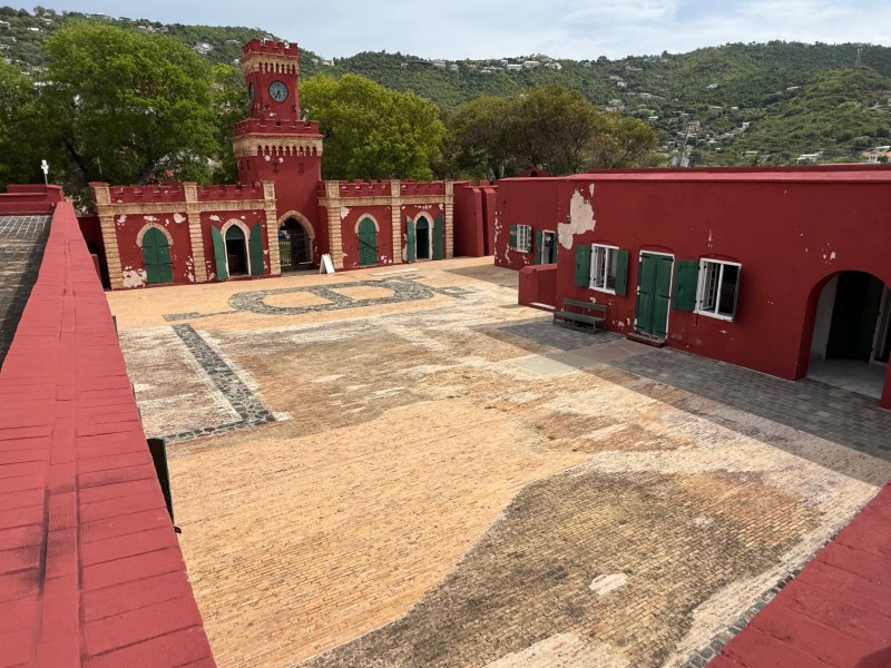
Fort Christian in Charlotte Amalie
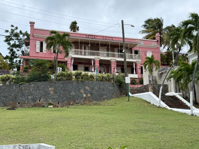
Hotel 1829 is one of many historic private residences that have been restored and transformed into hotels.

“99 steps” built in the 1700s to help people navigate the steep hills of Charlotte Amalie. Built with the bricks brought from Denmark as ship ballast
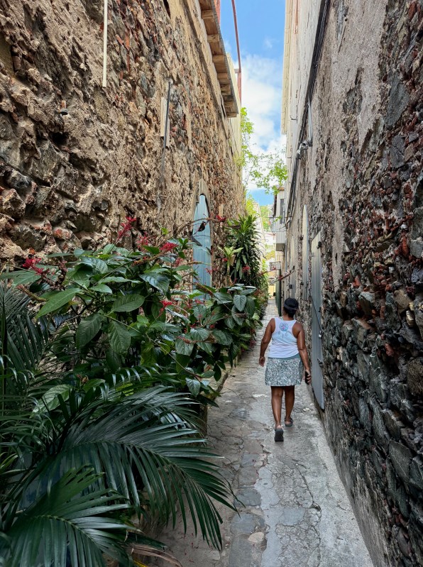
Many waterfront properties, separated by narrow alleys, have been carefully restored.
Water Island
A 30 minute ferry ride from Crown Bay will take you to Water Island, where renting a golf cart is highly recommended to navigate the island’s steep and circuitous roads. A quick orientation by the helpful staff at Rachel’s Golf Cart rental and a curious hand drawn map sent us on our way to wander through this island with an interesting history. The map didn’t last long; after a few wrong turns, we gave up and let Google Maps take over.
A short trail off the road led us to Limestone Beach. The shoreline was edged with sargassum, but the beach itself was quiet and undeniably beautiful, with hardly another soul in sight. We wandered along the sand, beachcombing for shells and anything that caught our eye. Several times, a cluster of dorsal fins stirred the water just offshore—possibly tarpon. We watched for awhile and then made our way back up the hill.
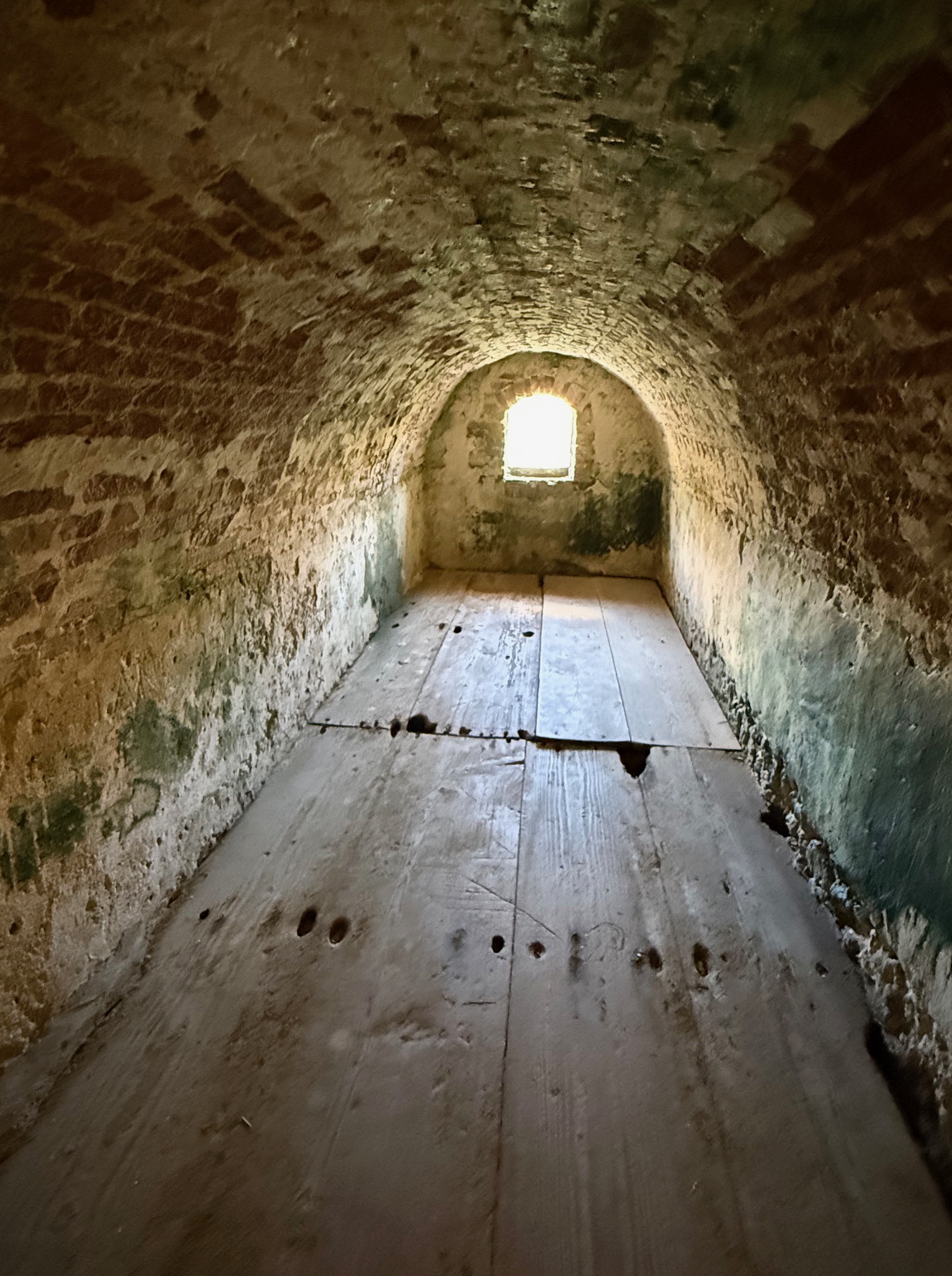
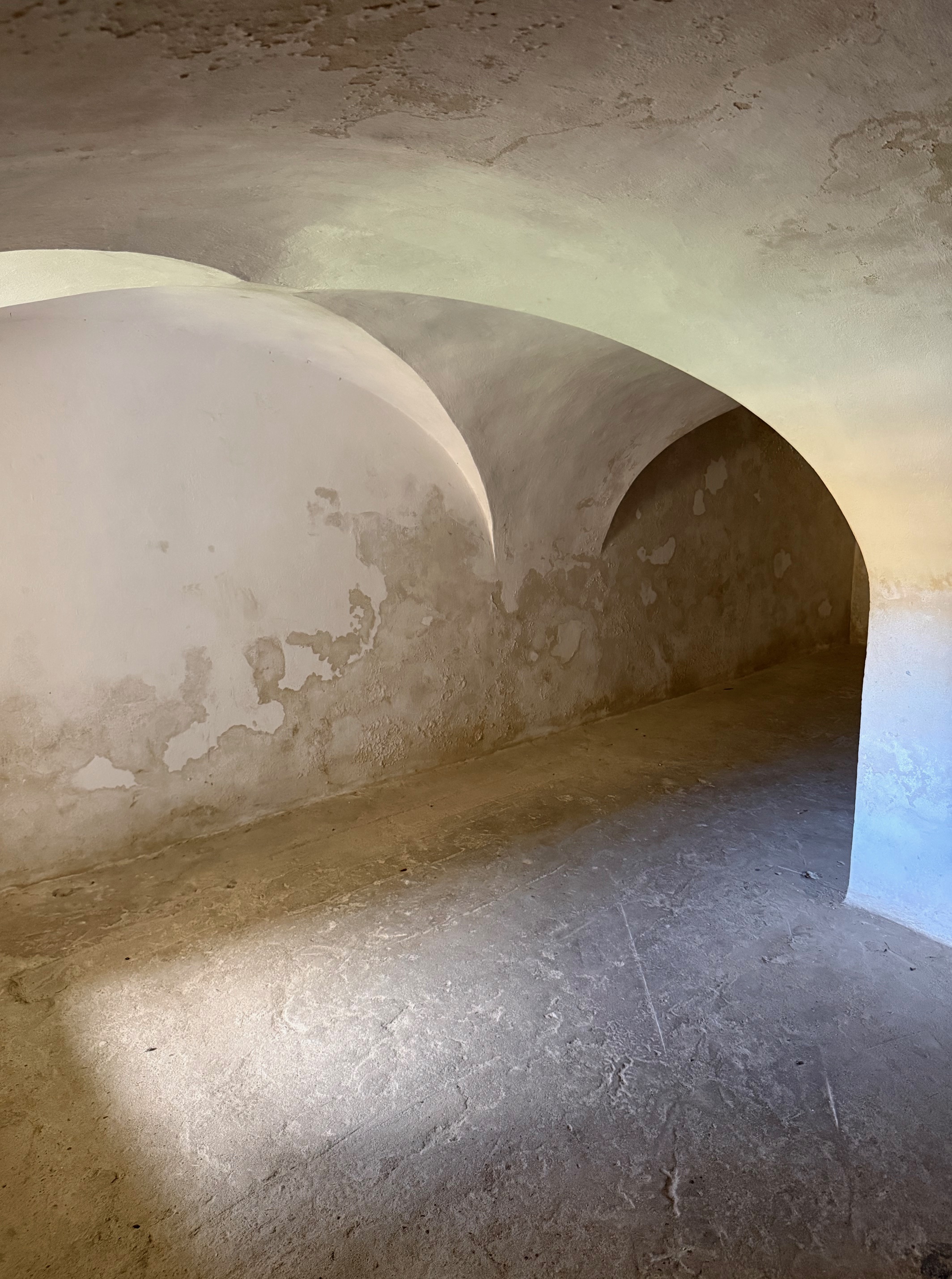
Our next stop was Fort Segarra, perched on a hill at the island’s southern end, overlooking the Caribbean Sea. The golf cart protested on the steep climb as Sunil carefully navigated around deep potholes. Built by the United States during World War II as a defensive outpost, the fort was never actually completed and used before the war came to an end. Today, parts of it have been restored, and you can wander through its tunnels, bunkers, and pillbox.
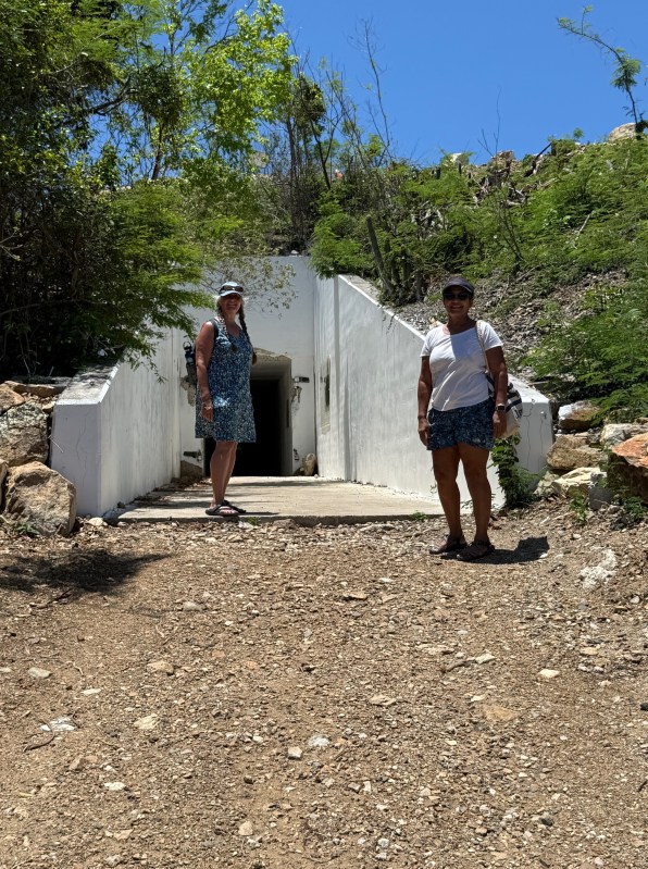
Approach and entrance to fort Segarra

Concrete tunnels and bunkers
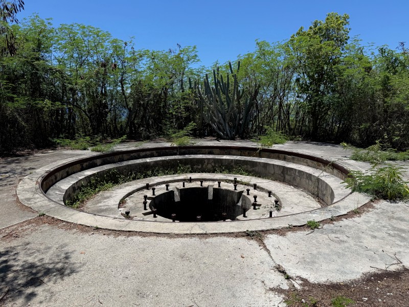
Guns were never installed
We were ready for lunch, and headed up to Heidi’s Honeymoon Grill on top of Providence Hill. Known for its fish tacos—and a “poop deck” (their restrooms) with one of the best views on the island—it definitely lived up to its reputation.
The tacos were excellent, fresh and flavorful, and the sweeping view made the meal even better. It’s the kind of place that invites you to slow down and stay awhile, soaking in the scenery long after the meal is over.
Our last stop of the day was Honeymoon Beach. The snorkeling there was a perfect way to unwind—we drifted lazily through the designated swim area, enjoying the cool water after a hot afternoon of exploring.

Honeymoon Beach (Photograph Credit -Micki)
The heat eventually steered us toward a well-earned treat, and Micki treated me to a Rocky Road ice cream from Dinghy’s Beach Bar, which hit the spot. Before we knew it, it was time to return our trusty golf cart and make our way back to catch the ferry, wrapping up a full and memorable day on Water Island.
The next day was Micki’s last on the island. We said our goodbyes at Crown Bay Marina, where a taxi soon arrived to take her to the airport. Her visit had been full of good company and shared adventures, and as she left, we were already hoping for another visit at some other port.
We left soon thereafter, for St. Croix which was to be our last stop in the USVI
St Croix
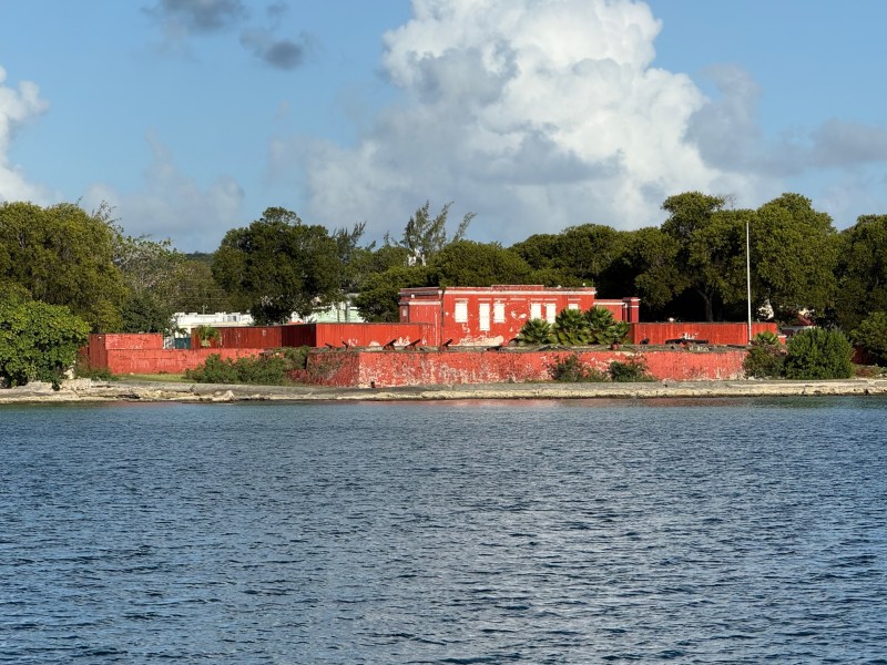
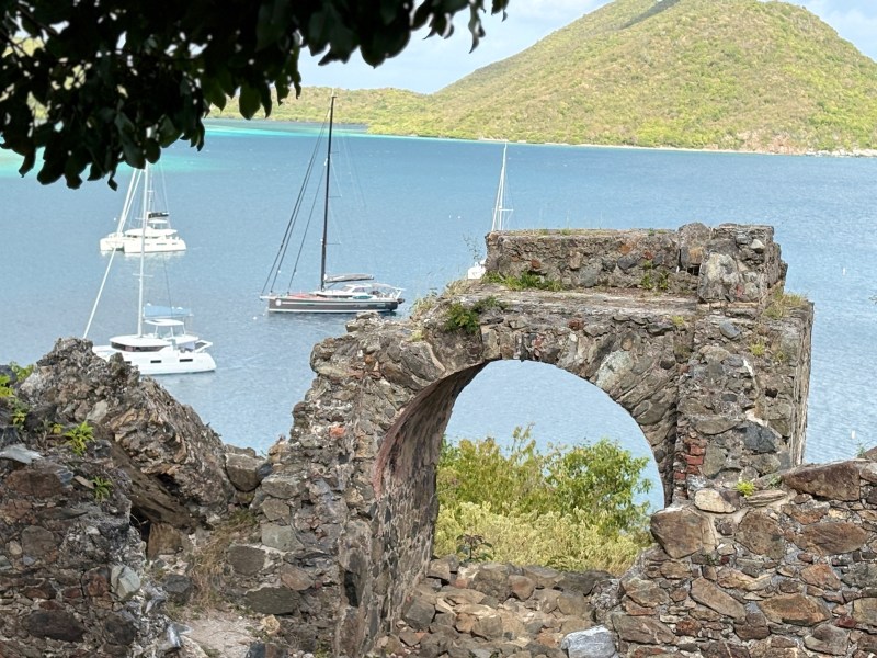
View of Fort Fredrick from our boat
We arrived in Frederiksted, one of the main towns on St. Croix, and dropped anchor in the bay alongside just one other boat. The waterfront is lined with 19th-century buildings, their faded facades hinting at a more vibrant past. There’s a quiet, slightly worn feel to the town—many structures showing signs of age and disrepair, a reminder of the challenges the island has faced in recent years, from hurricanes to the slowdown brought on by the pandemic.
The Danes were all about trade. Their forts were primarily for governance and control of their slaves, and secondarily for limited defense
Many of the historic sea front buildings have been beautifully restored
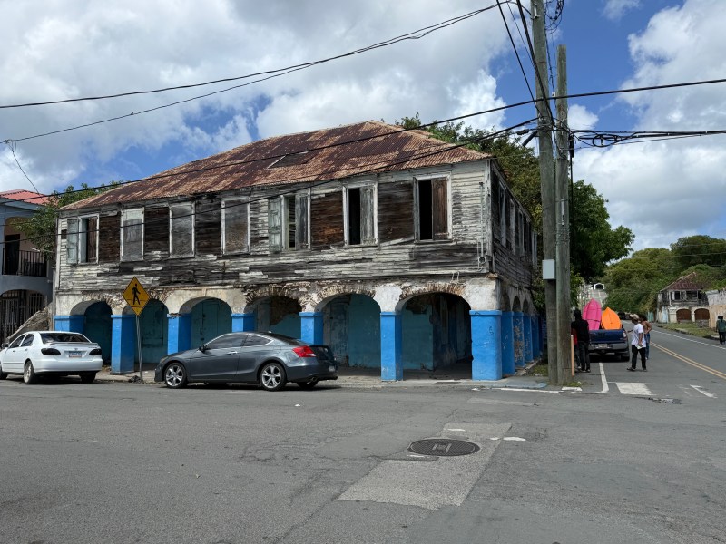
Others are waiting for capital intensive restoration work
That Sunday afternoon, the heat seemed to press everything into stillness. Most of the restaurants were closed, and the streets were nearly empty. The only spot with any activity was the Tail End Bar, where a subdued game of bingo was underway. It was a full house, but with no food in sight, we slipped out as quietly as we’d entered, careful not to disturb the game.
To really experience the island, renting a car is almost essential. Unlike the main land, you drive on the “wrong” side of the road and steering wheels are on the right side. We rented a Jeep, but unexpectedly, the steering wheel was on the left hand side which made for some interesting driving particularly on turns.
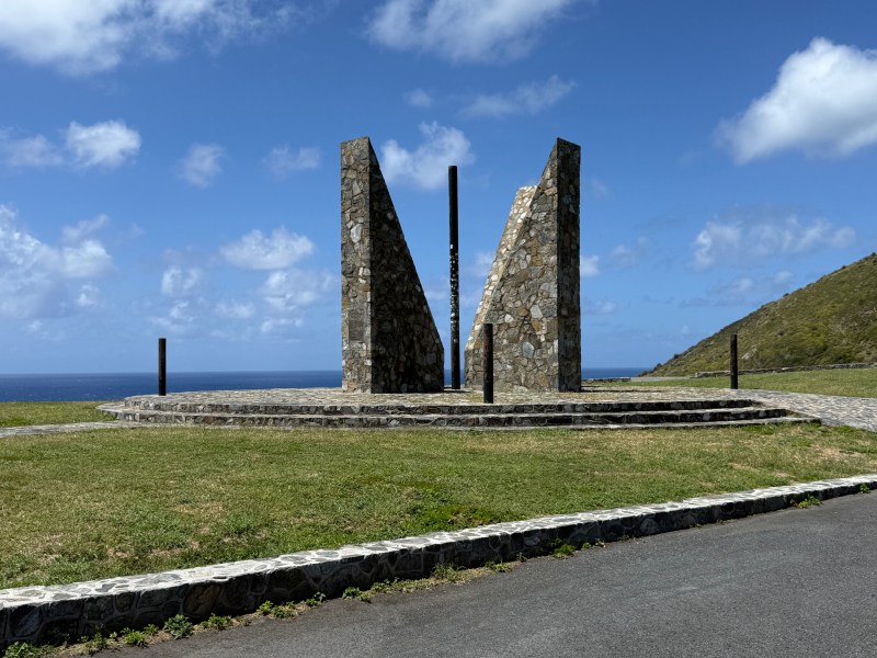
Fortunately, the main roads on the island are wide and generally well maintained. We made our way to Point Udall, the easternmost point of the United States, marked by the Millennium Monument, built in 2000 to welcome the new millennium. The monument itself is designed as a giant sundial—fitting for a place that’s often described as the first to see the sunrise in the U.S.
The eastern most point of USA
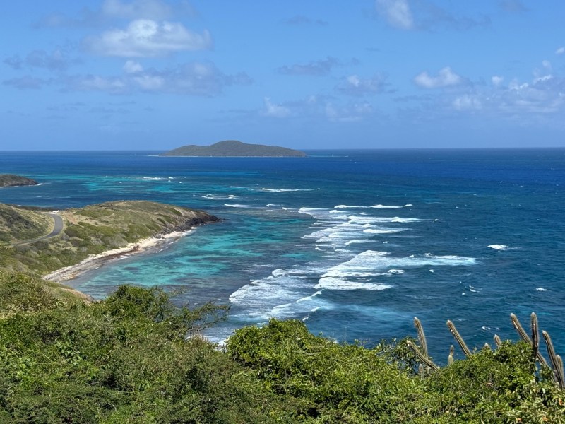
The views from the Point are spectacular. The Caribbean stretches endlessly outward, while the St. Croix coastline curves away below, resplendent with reefs and framed by waves crashing against the shore. On the winding drive from the point to Christiansted, we found ourselves pulling over again and again—at scenic overlooks, quiet beaches, anywhere the view demanded a pause. The sea never really loses its hold on me. Even living aboard a yacht, surrounded by it every day, it still manages to enthrall—always shifting, always captivating.
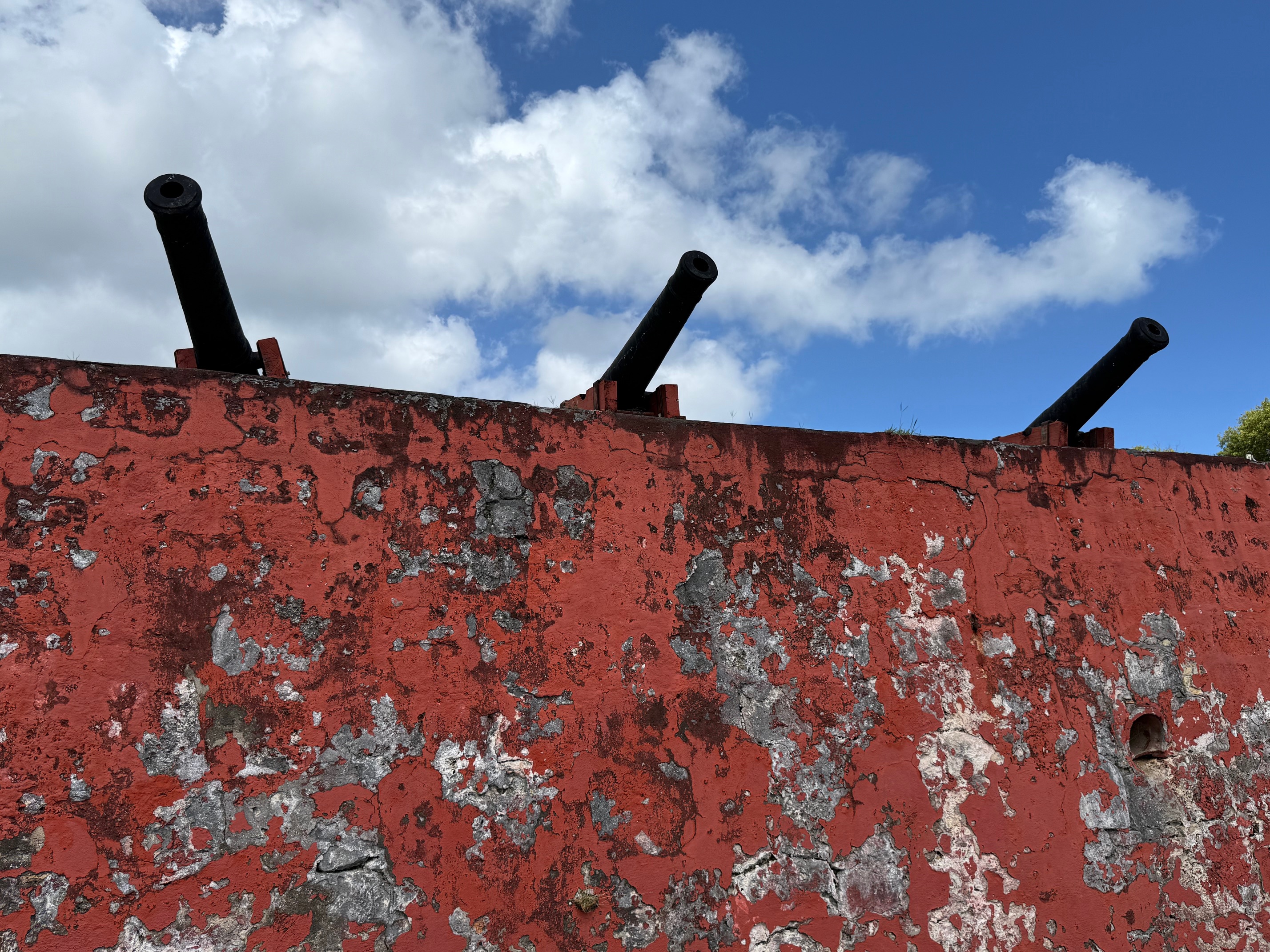
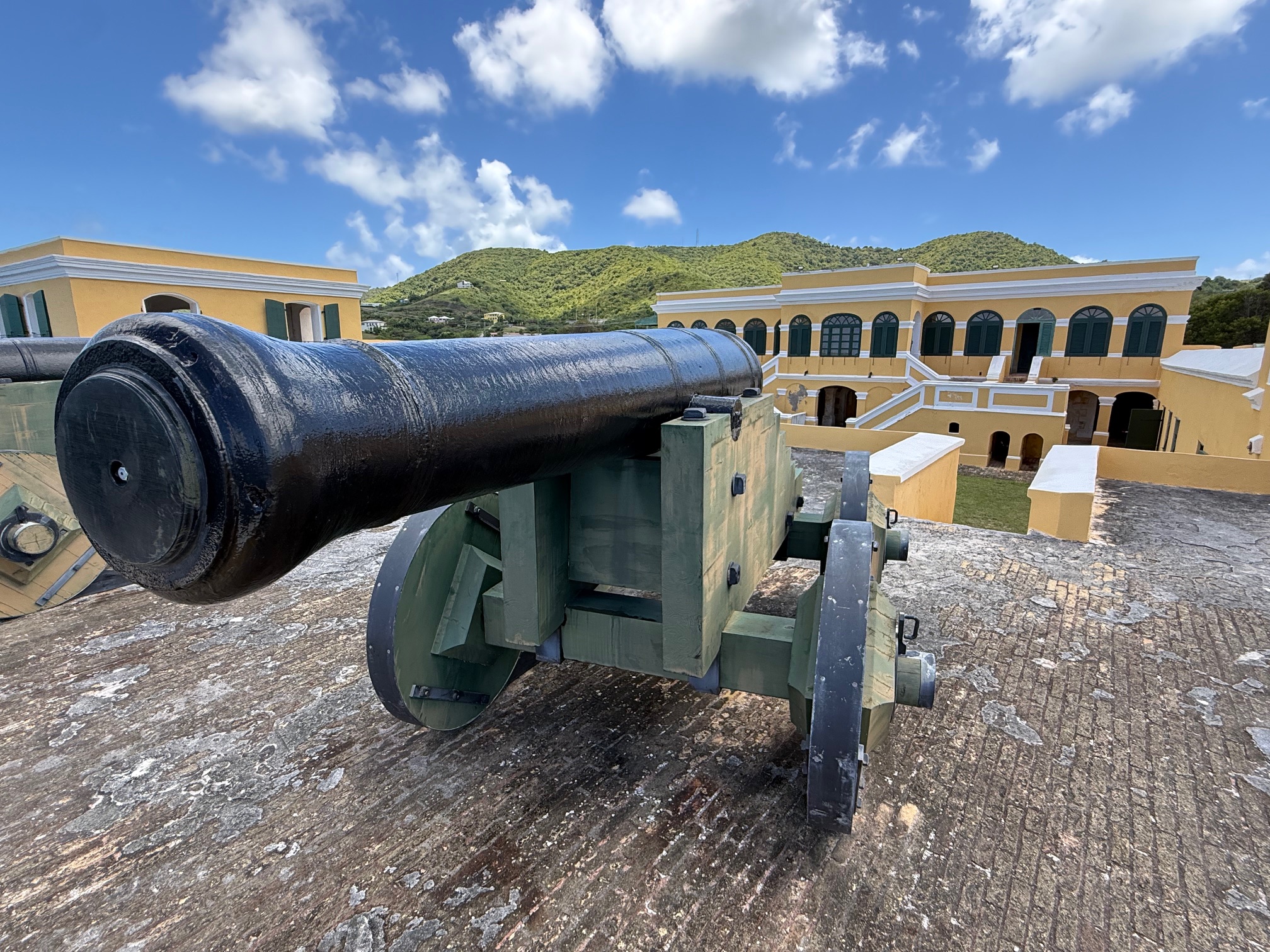
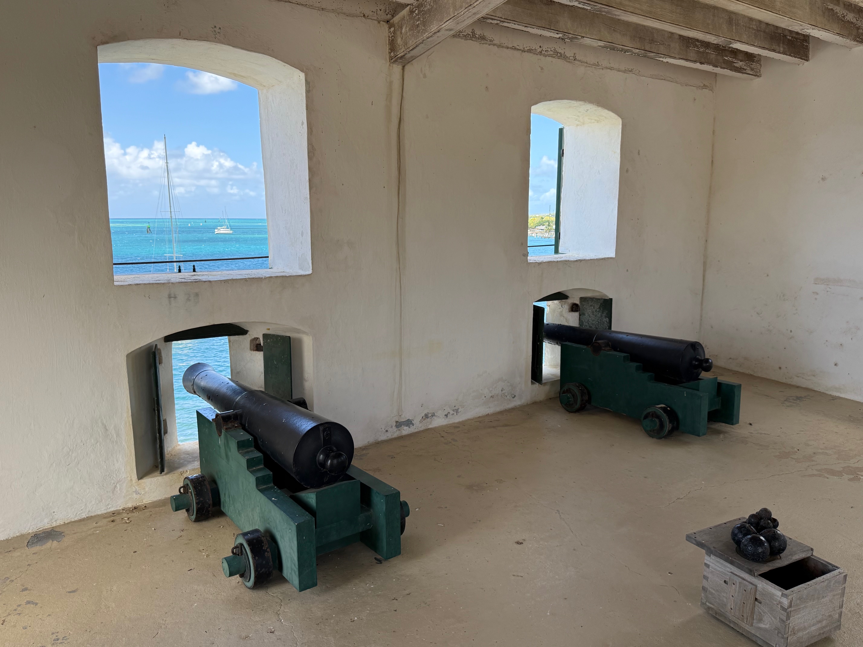
Christiansted, the largest town in St. Croix, is home to the Christiansted National Historic Site, a collection of well-preserved colonial buildings that offer a window into the island’s past. The centerpiece is Fort Christiansværn, constructed in 1738, its distinctive yellow walls standing guard over the harbor as they have for centuries. Walking through the grounds, it’s easy to imagine the town during its Danish colonial era, when Christiansted was a busy hub of trade and activity.
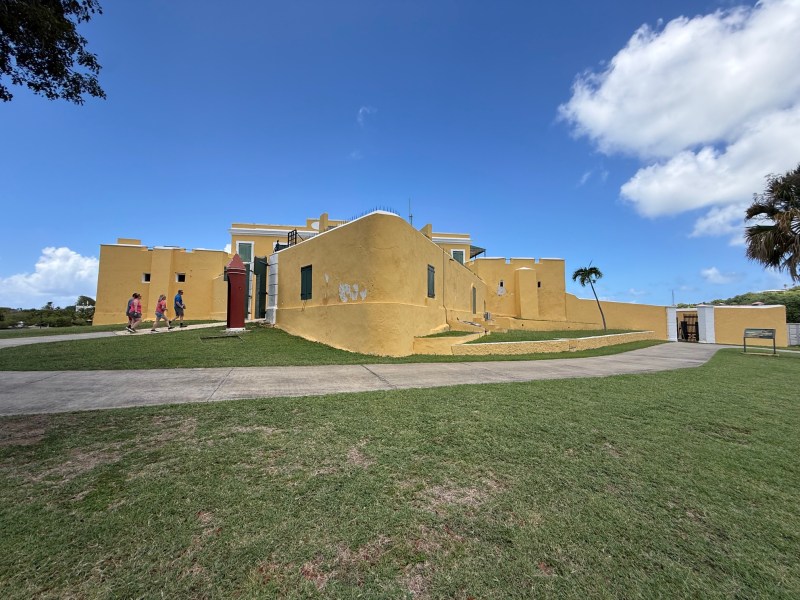
Fort Christiansværn guarded the harbor of Christiansted and remains one of the best-preserved Danish colonial forts in the Caribbean.
We stopped for lunch at Shupe’s on the Boardwalk, a casual spot where you jot down your order on a slip of paper and your meal arrives in a brown paper sack. I’ll admit, I was expecting traditional table service and felt a flicker of disappointment at first—but that didn’t last long. The food made up for it, simple, satisfying, and exactly what we needed after a morning of exploring.

We kept a close eye on the weather, waiting for the right window to make the long passage from St. Croix to Guadeloupe. The plan was to sail—possibly motor—almost directly upwind for about 48 hours, so even a slight easterly shift in the winds would make a big difference. Encouragingly, most of the weather models hinted that such a shift might arrive later in the week.
In the meantime, two massive cruise ships pulled into port, and Frederiksted transformed almost overnight. What had been a quiet, sleepy town suddenly buzzed with activity—beach umbrellas and loungers appeared along the shore, and rows of vendor tents lined the streets.
We had been hoping to snorkel under the ferry pier, one of Frederiksted’s main attractions, but that plan was quickly shut down by a stern official guarding the area. Disappointed, we moved on to another pier—and ended up with an even better experience. Just below us, a giant ray glided gracefully through the water, lingering for a moment before slipping into the shadows. Nearby, a school of large tarpon cruised along the shoreline. An old submerged metal pipe had become a thriving reef, covered in bright corals and alive with angelfish, tangs, triggerfish, and wrasse. Starfish rested motionless on the seabed, and a turtle made a quiet appearance, rounding out the scene.
Before long, our departure day arrived. We set off in the late afternoon, hoping for a smooth, uneventful sail to Guadeloupe. Sometime during the night, one of the cruise ships that had filled the harbor earlier passed us in the distance, their deck lights blazing discordantly in the dark —a brief reminder of the bustle we had left behind.
