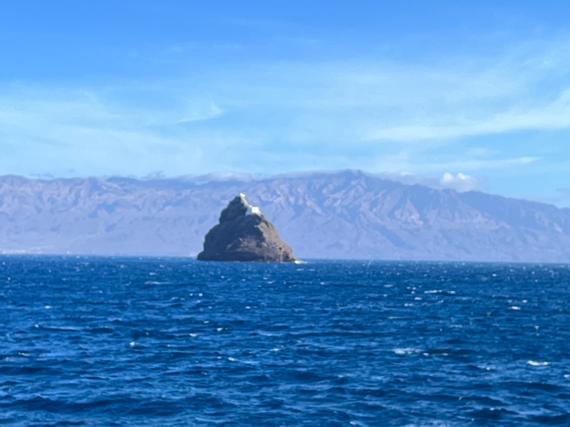
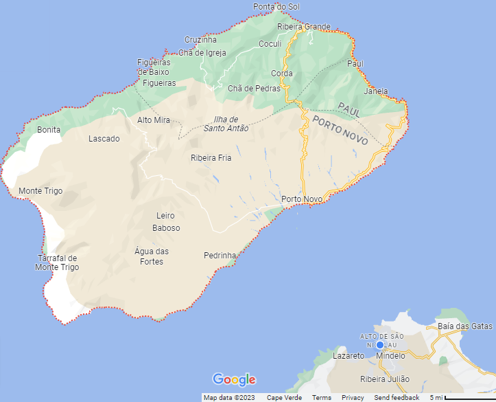
The first views of the island of Santo Antao, as you approach it, are impressive. Its tall volcanic peaks, shrouded in dense clouds, rise from the ocean like a scene from Jurassic Park. Only a narrow channel separates Santo Antao from Sao Vicente island. Due to the strong winds, and drift, our ferry takes a full hour to cross the channel from Mindelo to the town of Porto Novo. Along the way, it passes the unmistakable lighthouse rock in the Harbour Bay. It is Easter Sunday and so we have called ahead to reserve a taxi to take us across the island.
Porto Novo
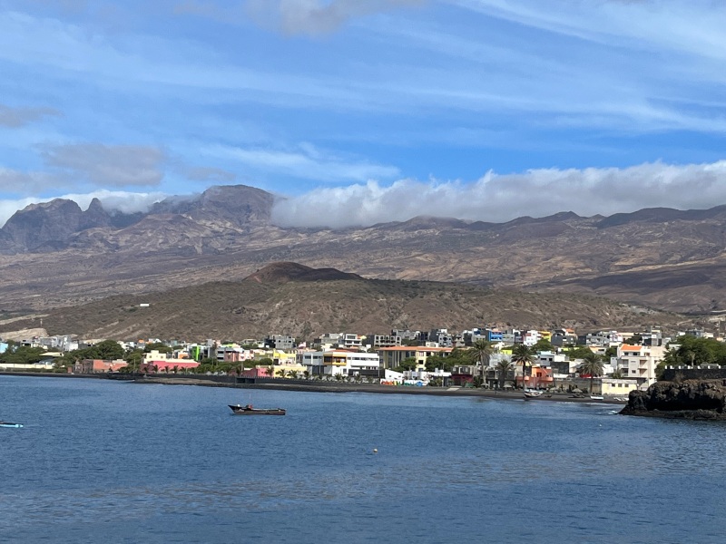
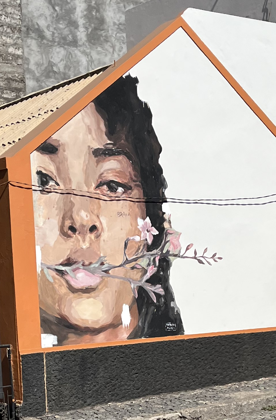
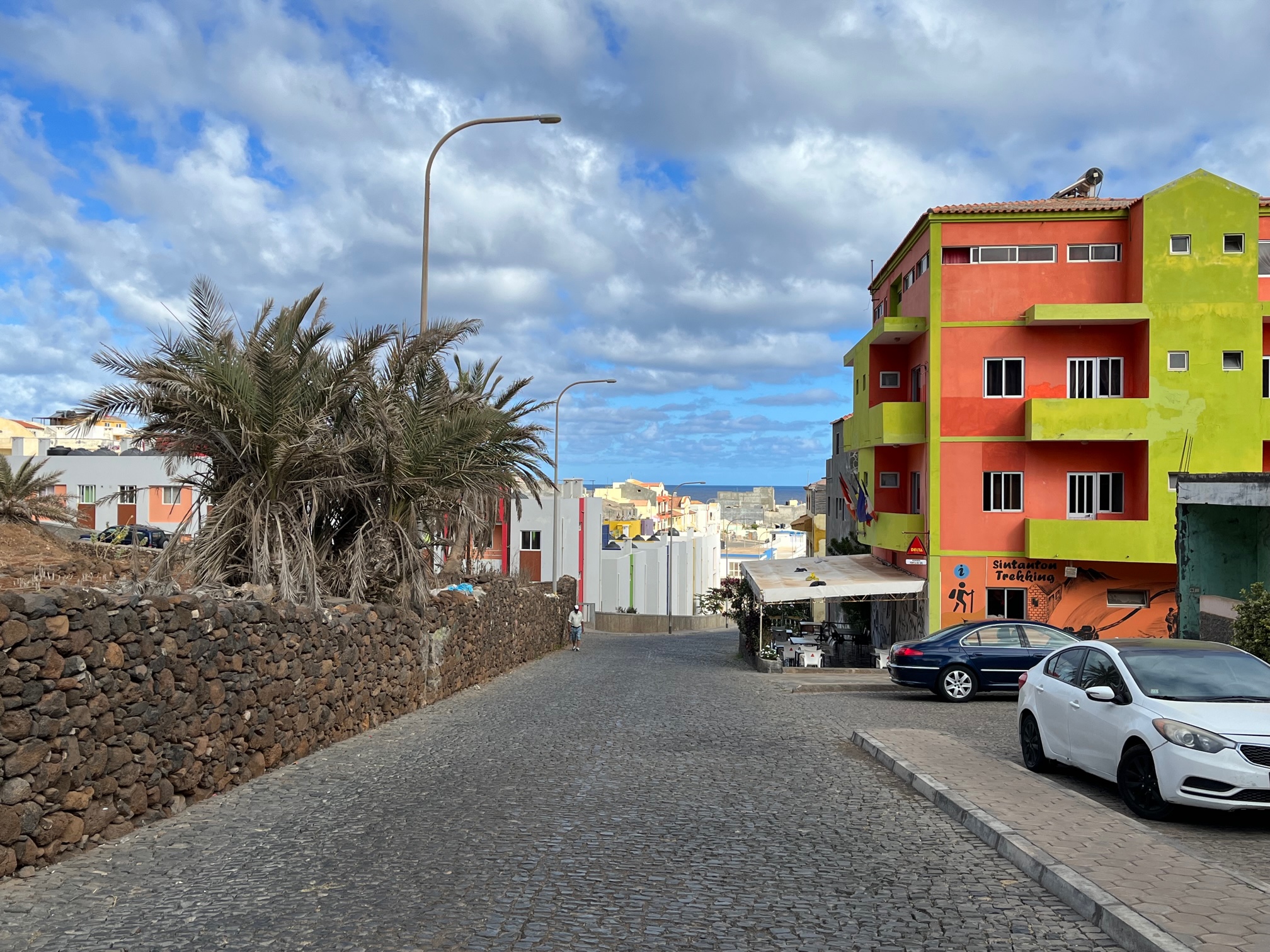
Porto Novo is a typical Cape Verdean coastal town with brightly colored row houses and amazing murals that I seem to find everywhere in this part of the world. The hot, arid and dusty slopes of the mountains form a contrasting background to the vibrant colors of Porto Novo.
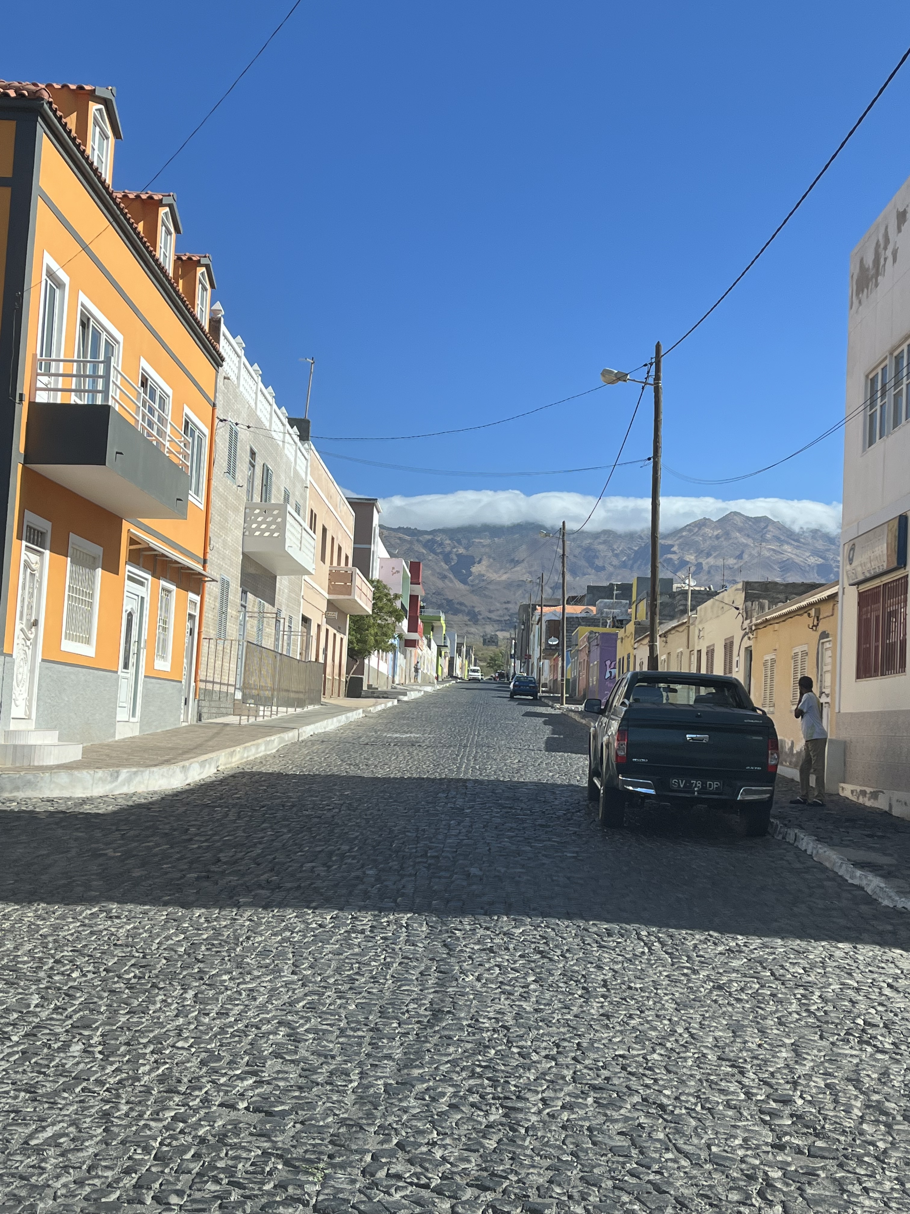
We get off the ferry at the modern ferry terminal in Porto Novo. As we stand around trying to get our bearings, a man approaches us asking if we need a taxi. We have one already we say, and are looking for Philip, the driver of our pre-arranged taxi. He turns and yells at a man in the distance, who yells to another and another till Philip has been located! The coconut radio in the island works much better than cellular. Within minutes we are seated in Philip’s taxi and headed out of town.
Philip will take us to the northern most point on the island – a town called Ponto do Sol – via the old road which climbs up the mountains onto the high plateau and then down to the coast on the other side.
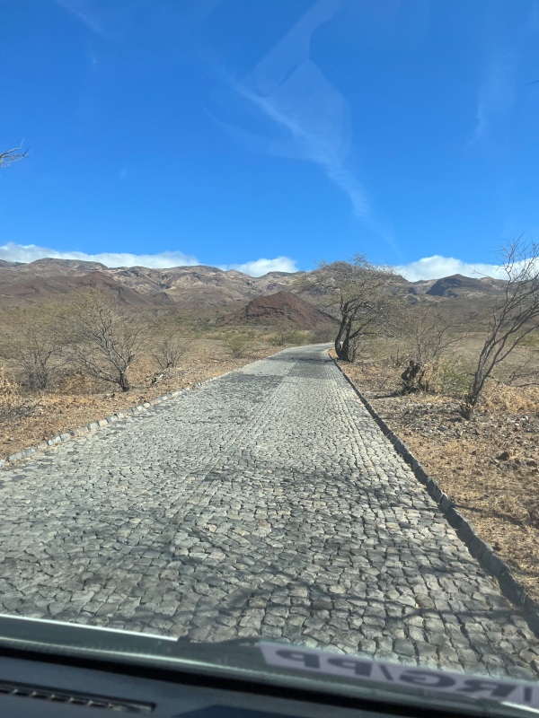
We start out in a hot desert landscape with sparse vegetation
The mountain road is made entirely of cobble stones, perfectly fitted with a clean well defined edge. It is clean and well maintained and surprisingly comfortable to drive on.
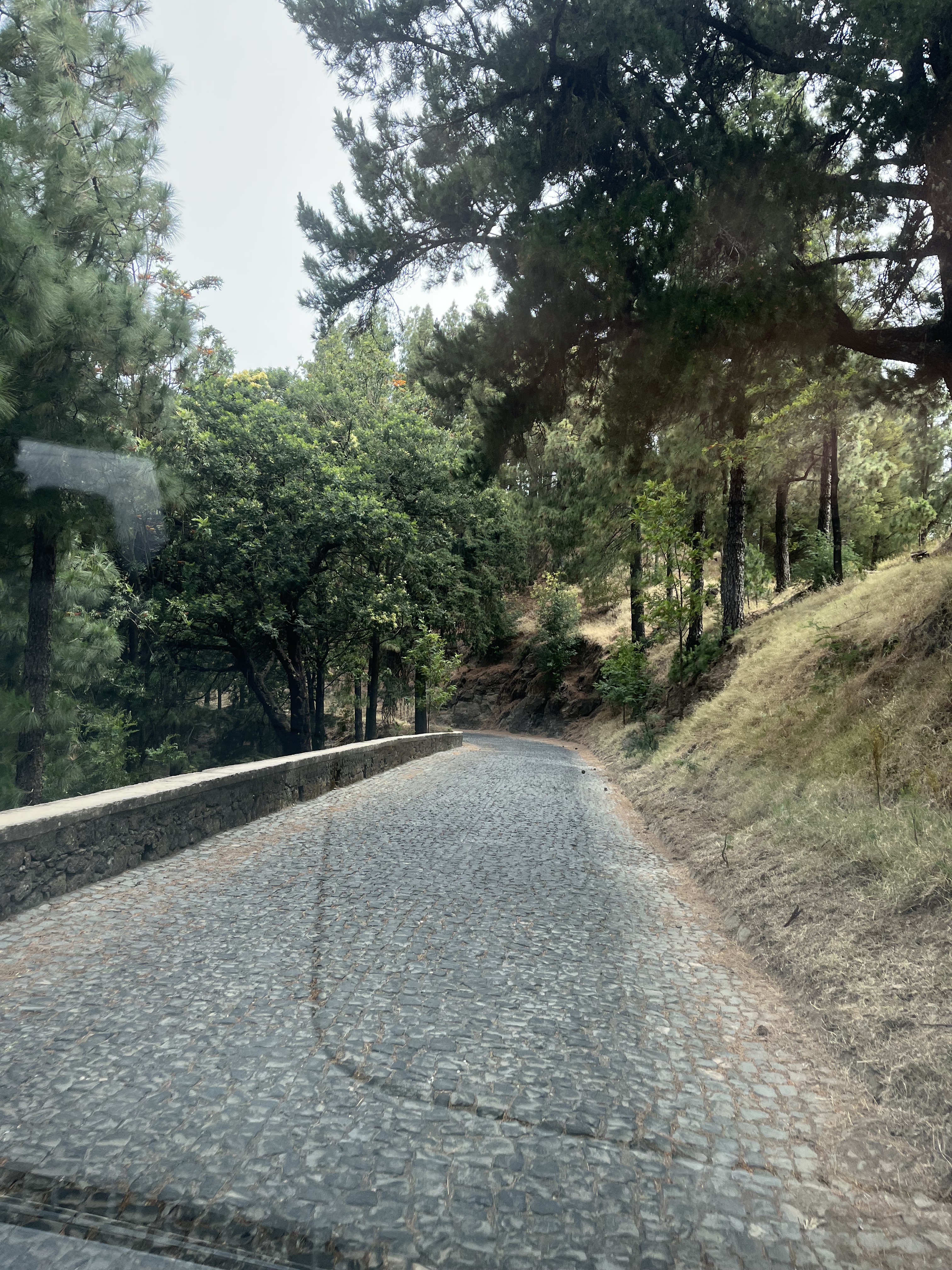
The vegetation turns green and dense as we climb higher
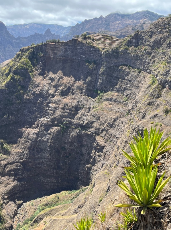
Up on the high plateau the views are simply breathtaking. The road travels along the western rim of the Cova Crater and over the narrow Delgadhino Ridge with deep valleys on either side. We stop often to drink in the beauty that surrounds us. Eucalyptus, cypress and pine tress grow on the gentler slopes of the mountain side. Only Agave seems to grow on the steep slopes.
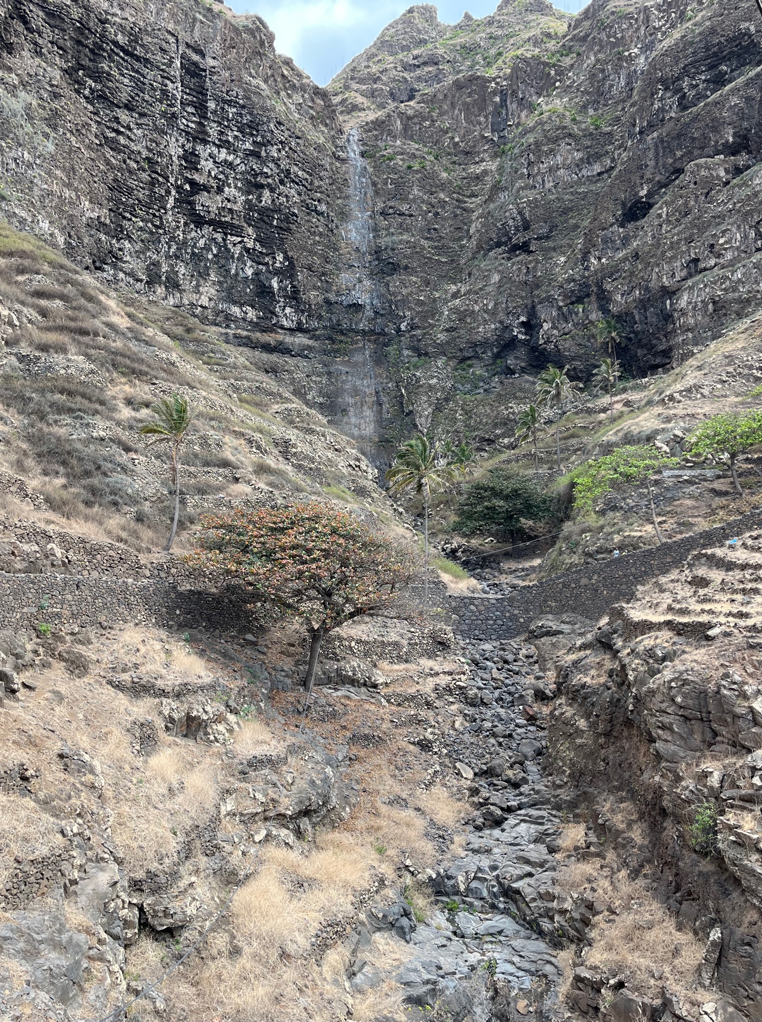
Dry waterfall.
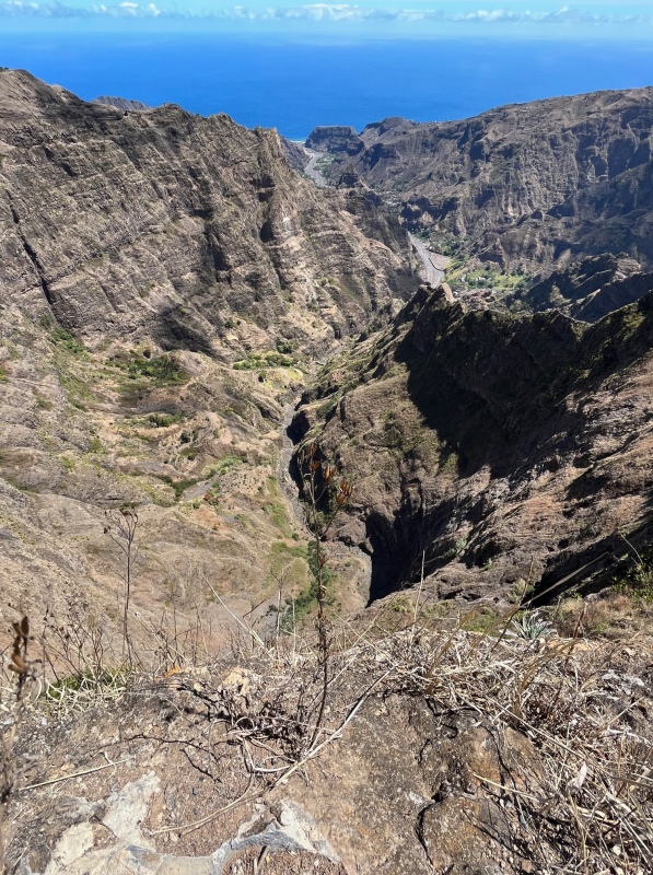
Far in the distance is the shimmering blue of the Atlantic ocean
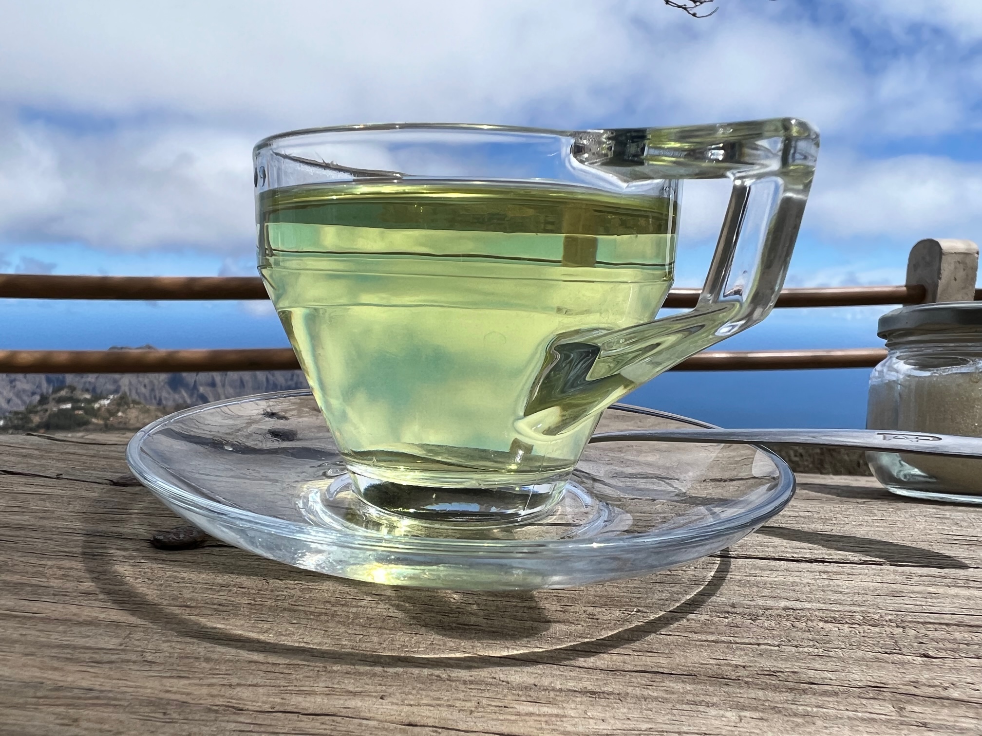
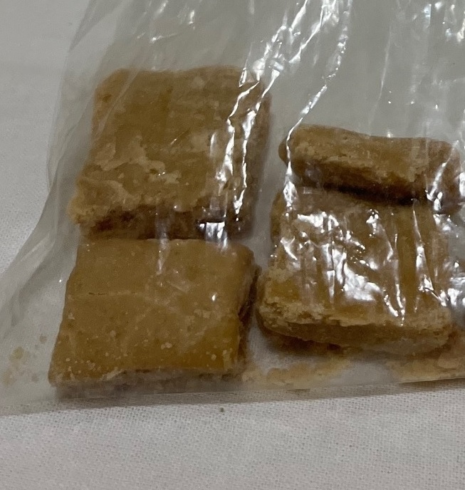
Along the way we pull up beside a small tea stall, where a young girl is preparing something over a stove. Philip asks for a cup of cha (tea) and we follow his lead. She looks around for a minute and then walks over to the nearby hillside and comes back with a handful of leaves that she steeps in the water that is boiling away. She prepares a tray and pours out our tea. There is a little display of Easter confections next to the window, which looks intriguing, so we buy some. She has made these herself this morning. Made of coffee, sugar and milk, they are the perfect accompaniment to the clear tea.
Ponto do Sol
We descend from the high plateau and arrive at Ponto do Sol on a spit of land at the base of the mountain. The town is a mix of old and new. All around we see signs of development. There are condos coming up along the waterfront. In a few years this place might have a whole different vibe.
We are staying at Sissi’s B&B. It is a comfortable place with simple facilities and a wonderful breakfast.
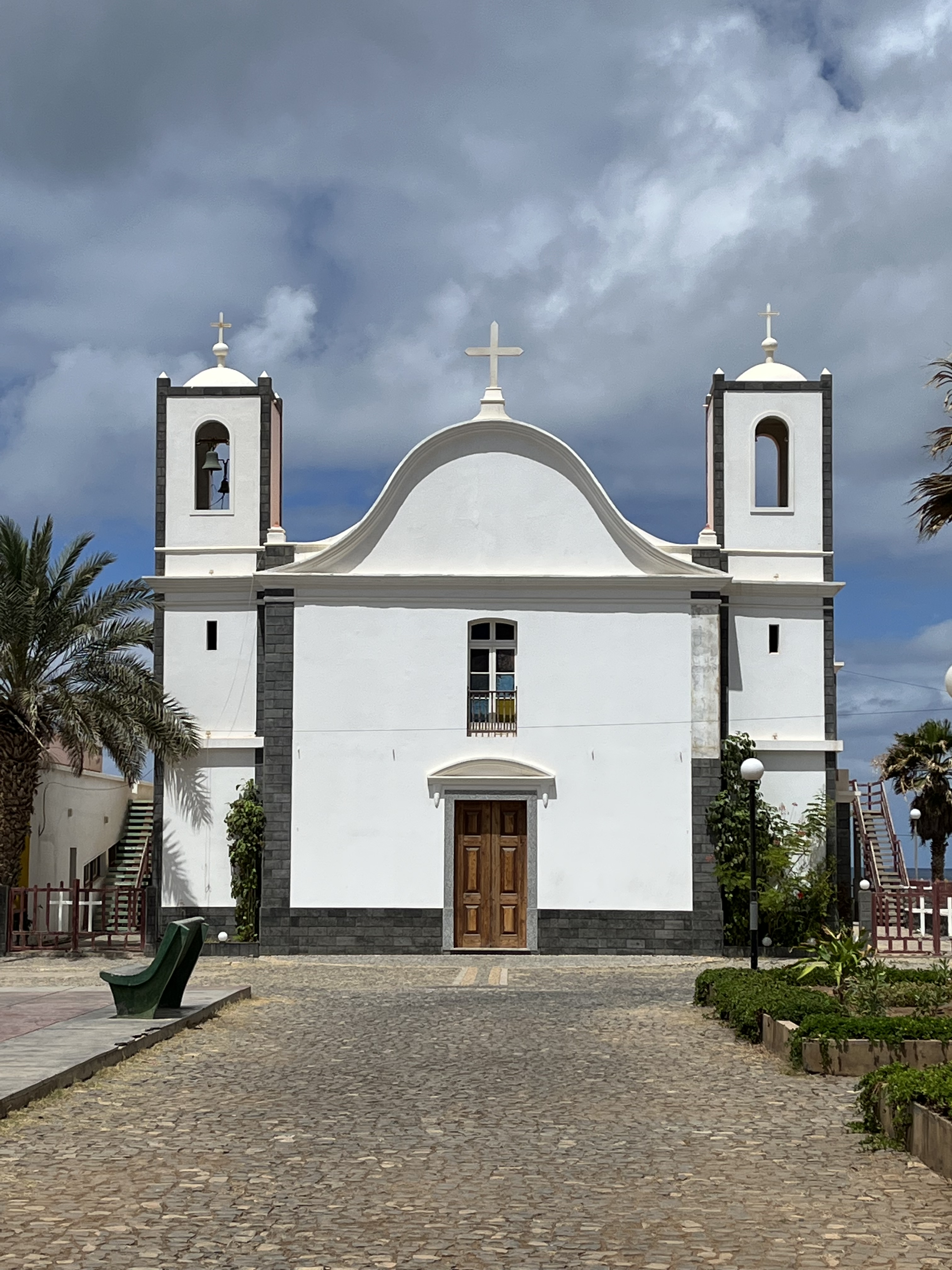
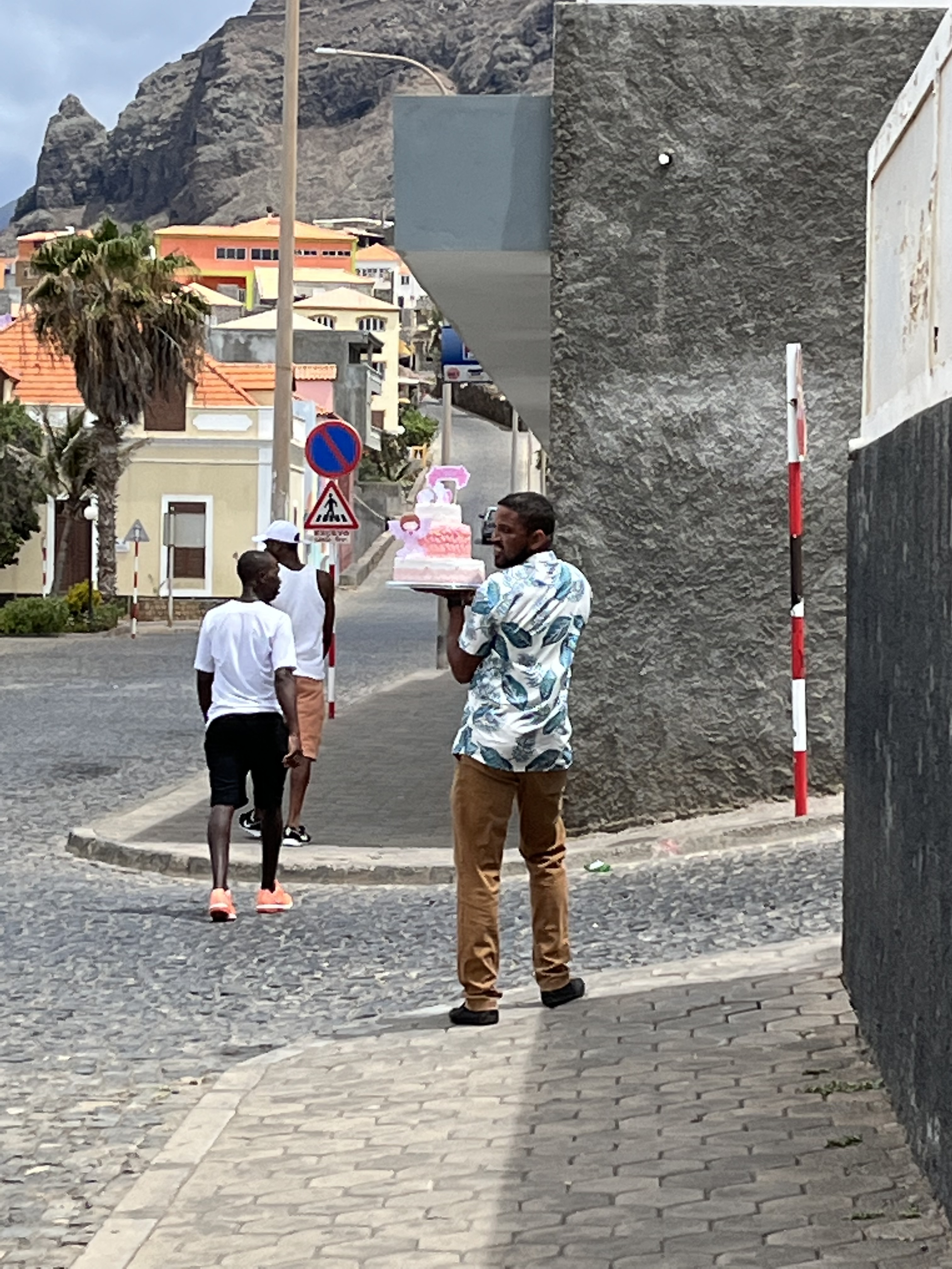
(L) The local church and square (R) Somebody’s getting a cake delivered
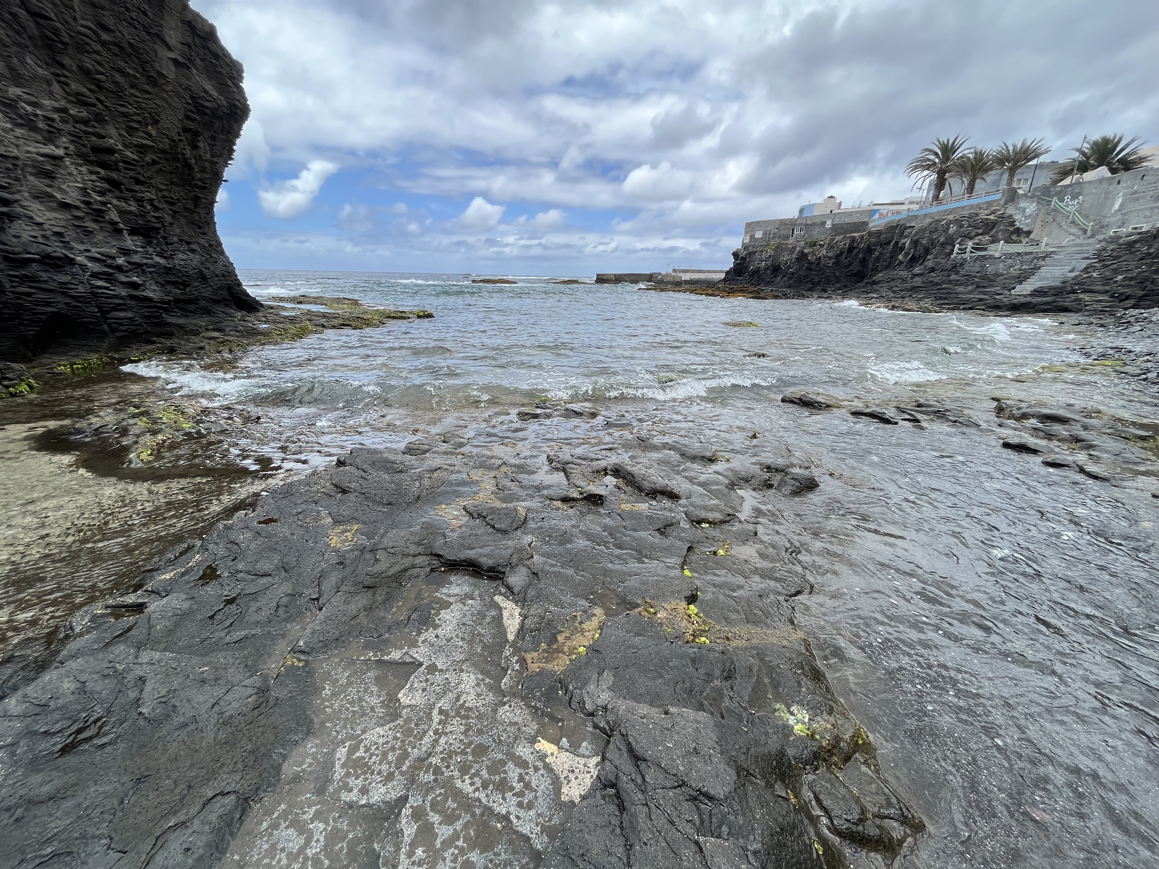
Tide pools along the water front provide places to lounge in the water
Fontainhas
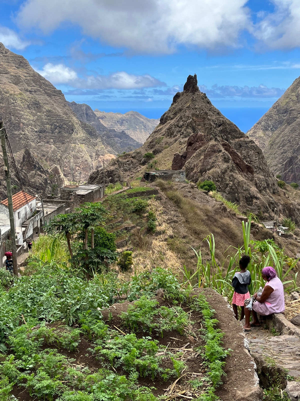
From Ponto do Sol we hike up to the tiny hamlet of Fontainhas. This village has some of the best views in the world- which has been recognized by National Geographic! Fontainhas is not unlike many other mountain villages in Santo Antao. The island has so many fascinating places.
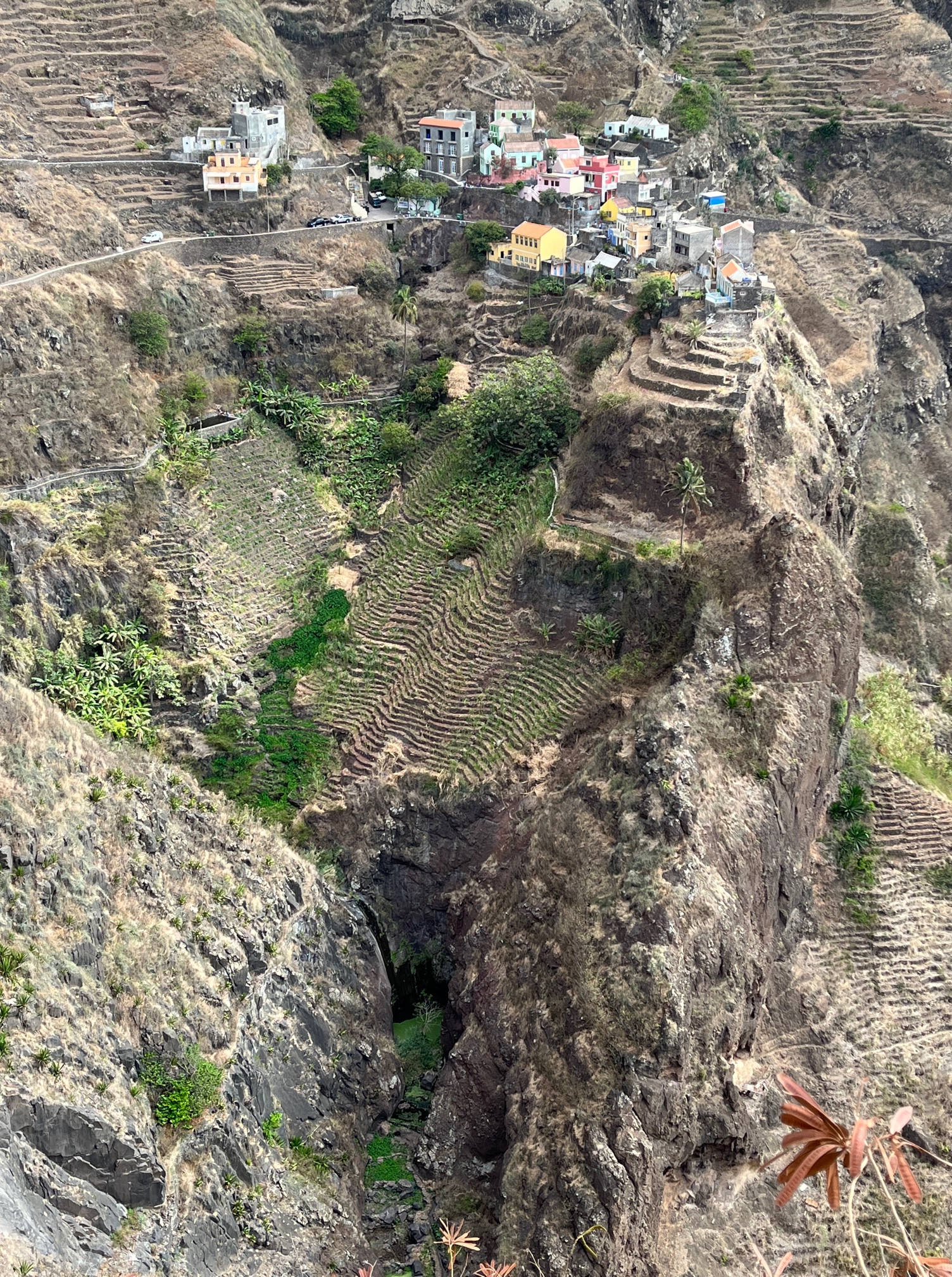
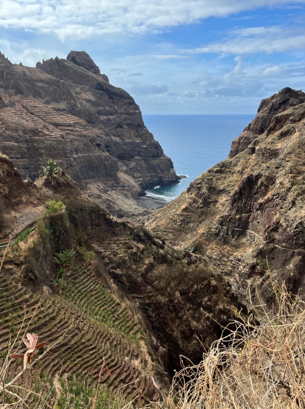
Fontainhas is perched on a thin ridge that rises up from terraced mountain sides. Far below is a valley that ends on a narrow black sand beach on the Atlantic.

Since it is Easter Sunday, we are lucky to find a musical event in progress in a little clearing among the cluster of homes. There are local and visiting artists performing.
Xoxo (pronounced sho-sho)
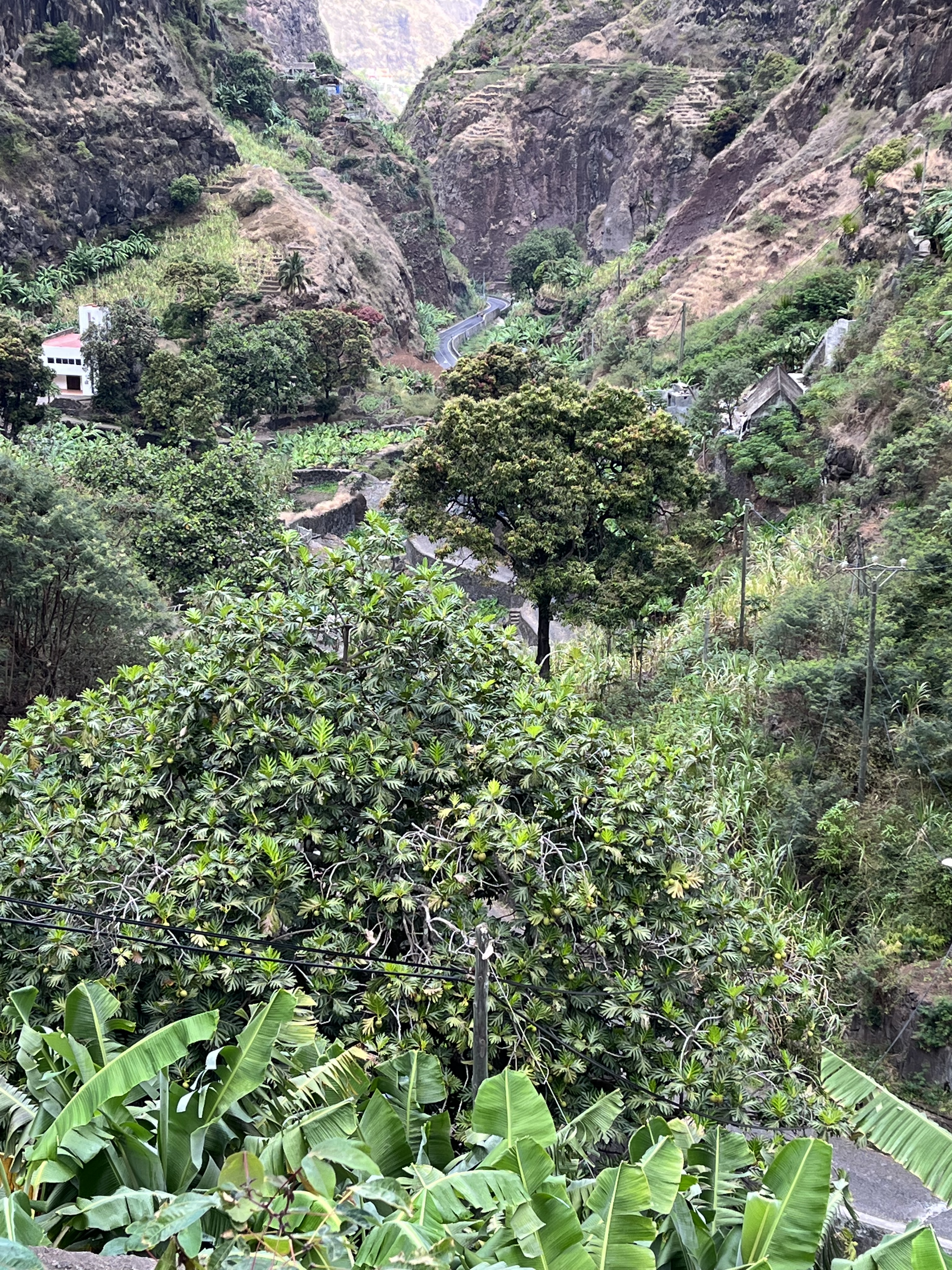
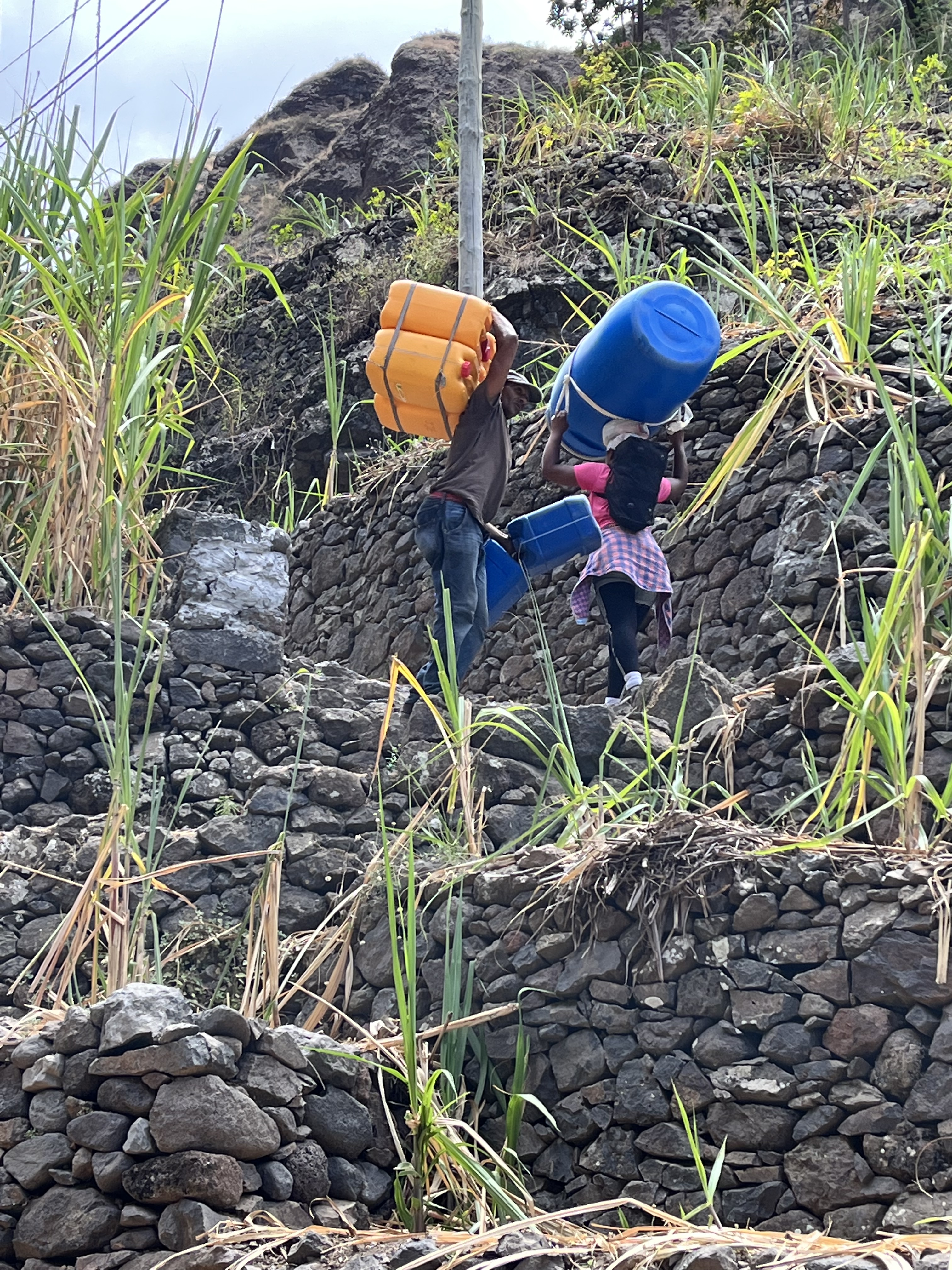
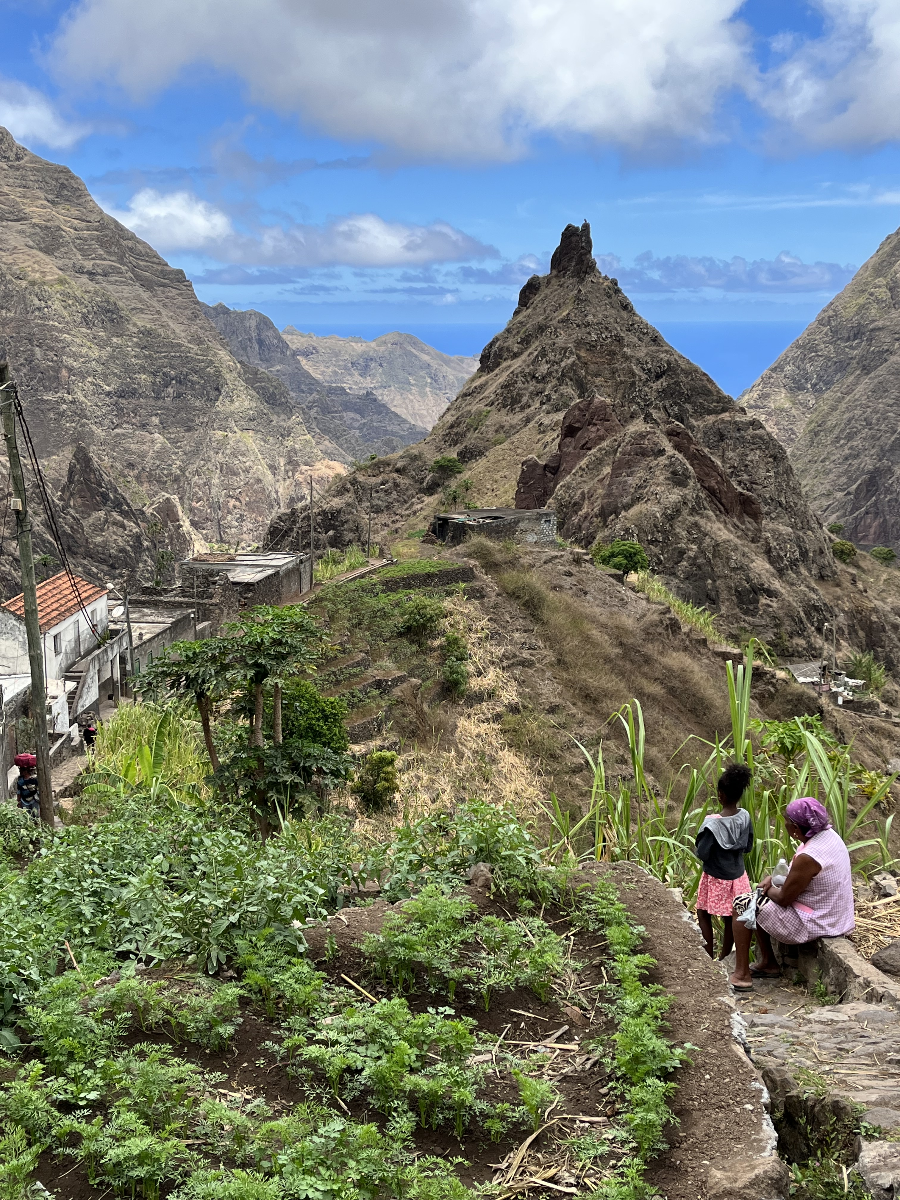
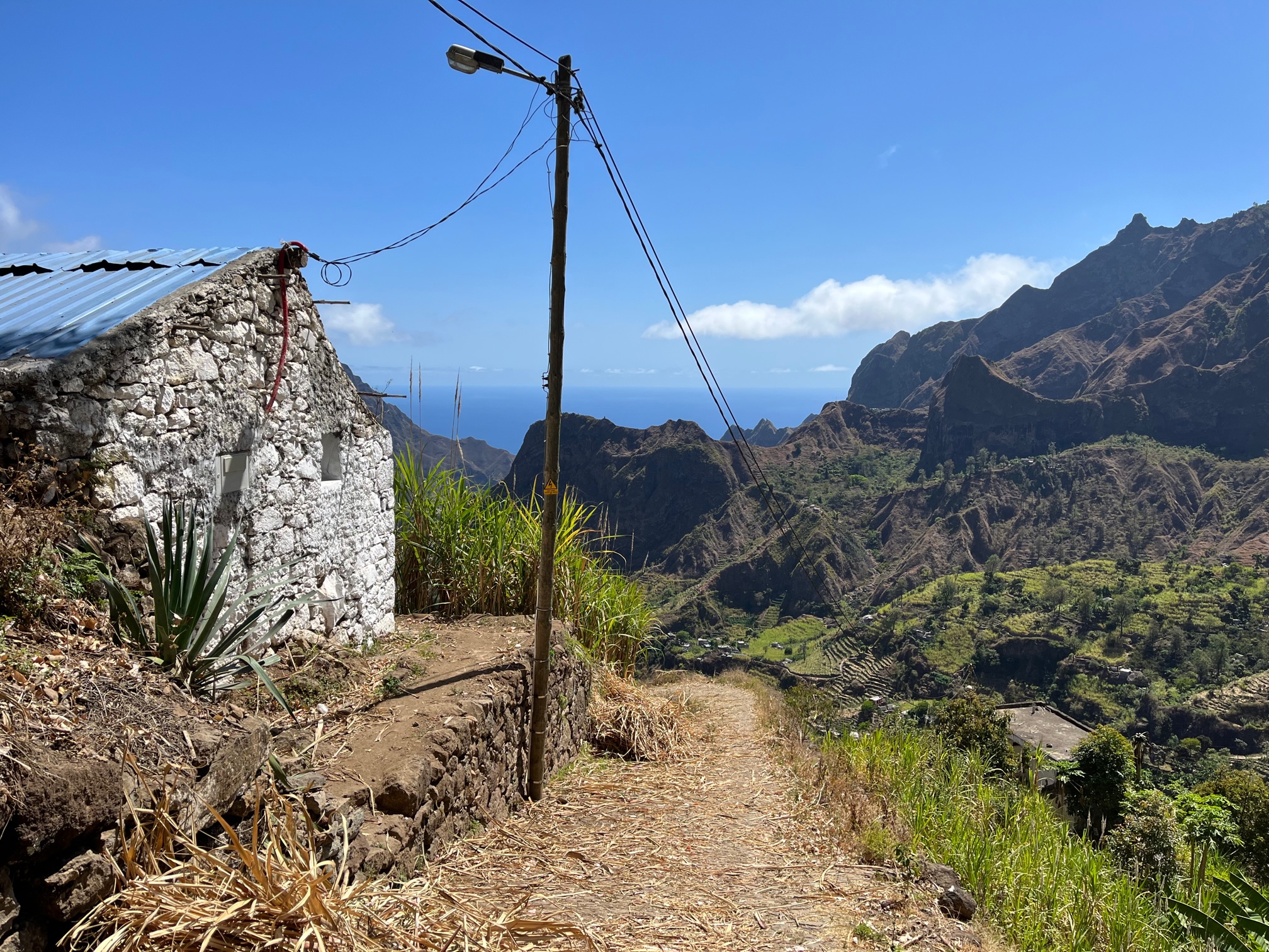
Xoxo lies at the end of a road that follows the Ribeira da Torre stream. April is dry season and the stream bed is mostly a dry wash. The high mountains block the clouds and higher up you can feel the moisture in the air – a fine mist that hovers along the hillside. The farmers have built canals, high up in the mountains, that capture underground water seeping from the slopes, and use periodic weep holes to direct water to their terraced fields. As a result the slopes are lush green like in the tropics. There is an enormous effort that has gone into farming the steep mountain sides.
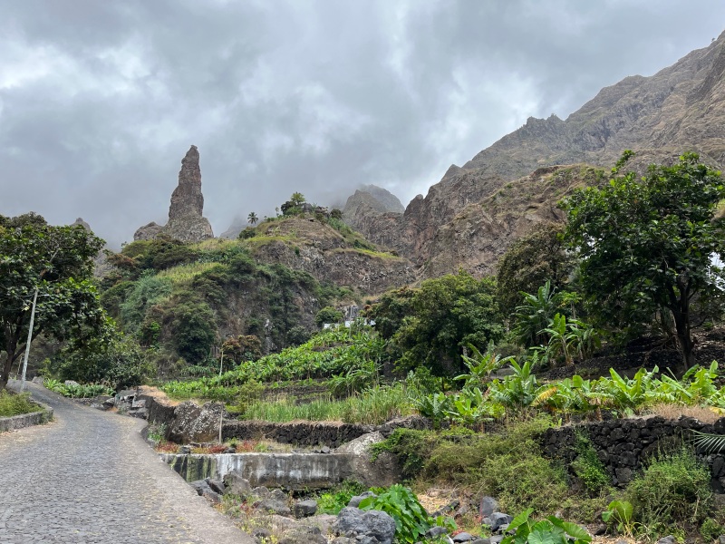
The curious Xoxo needle rock
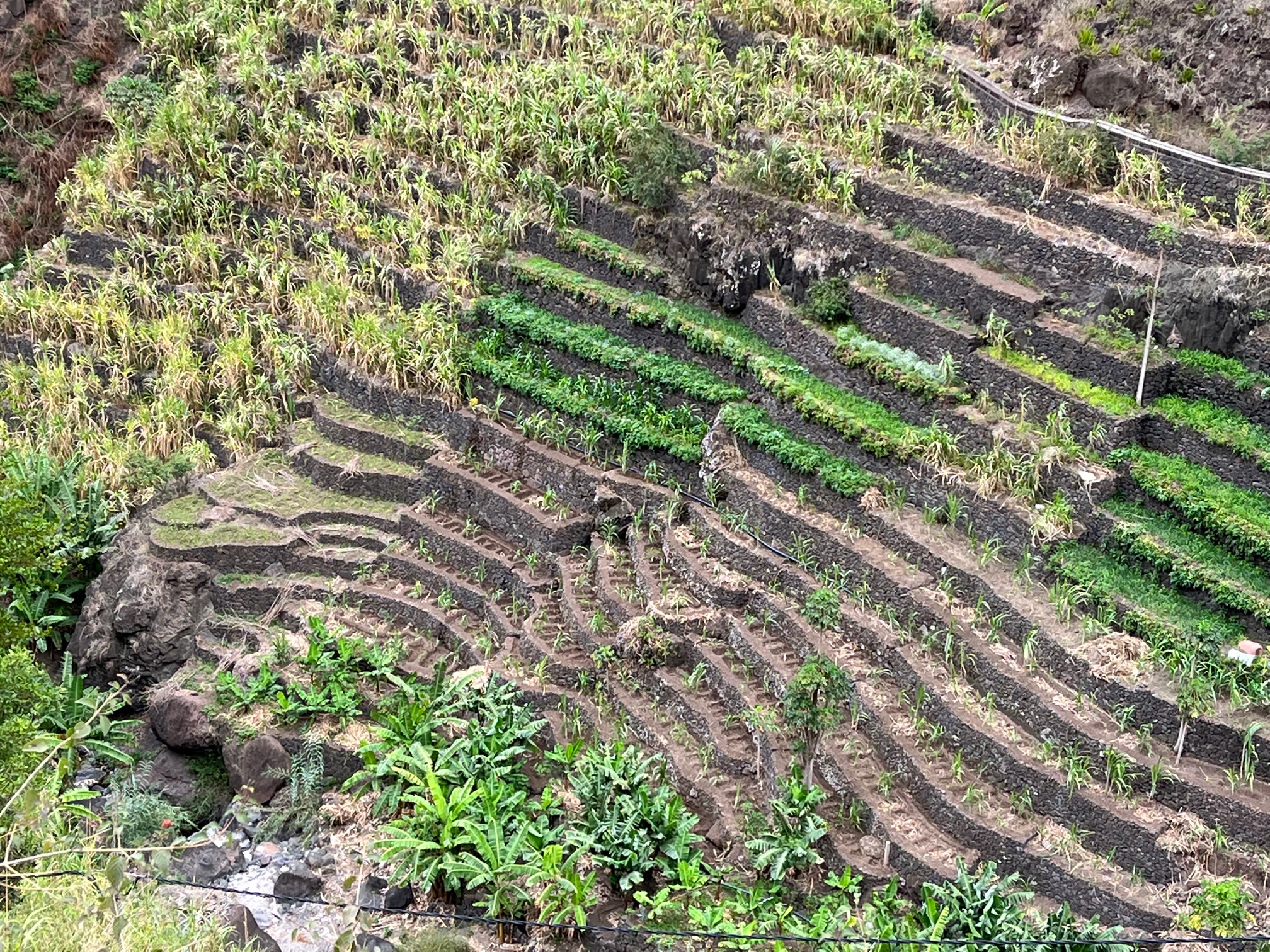
(L) Lush river valleys (R) Terraced cultivation on steep slopes
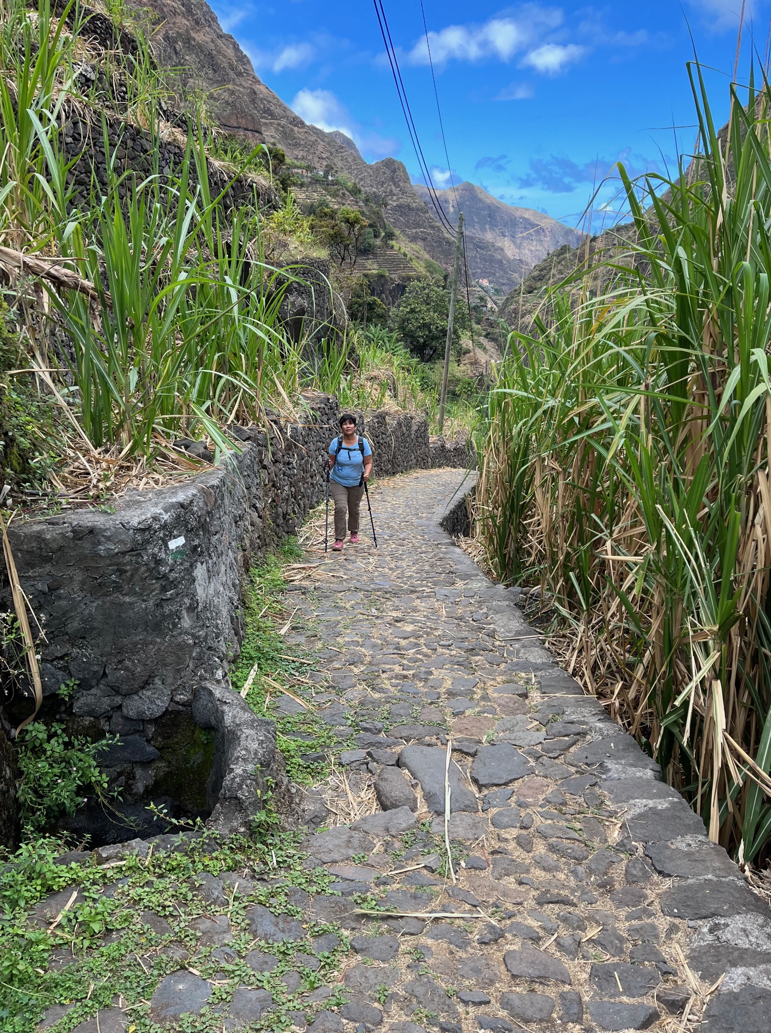
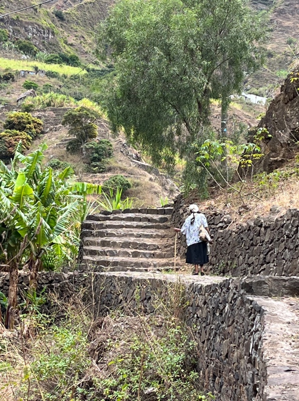
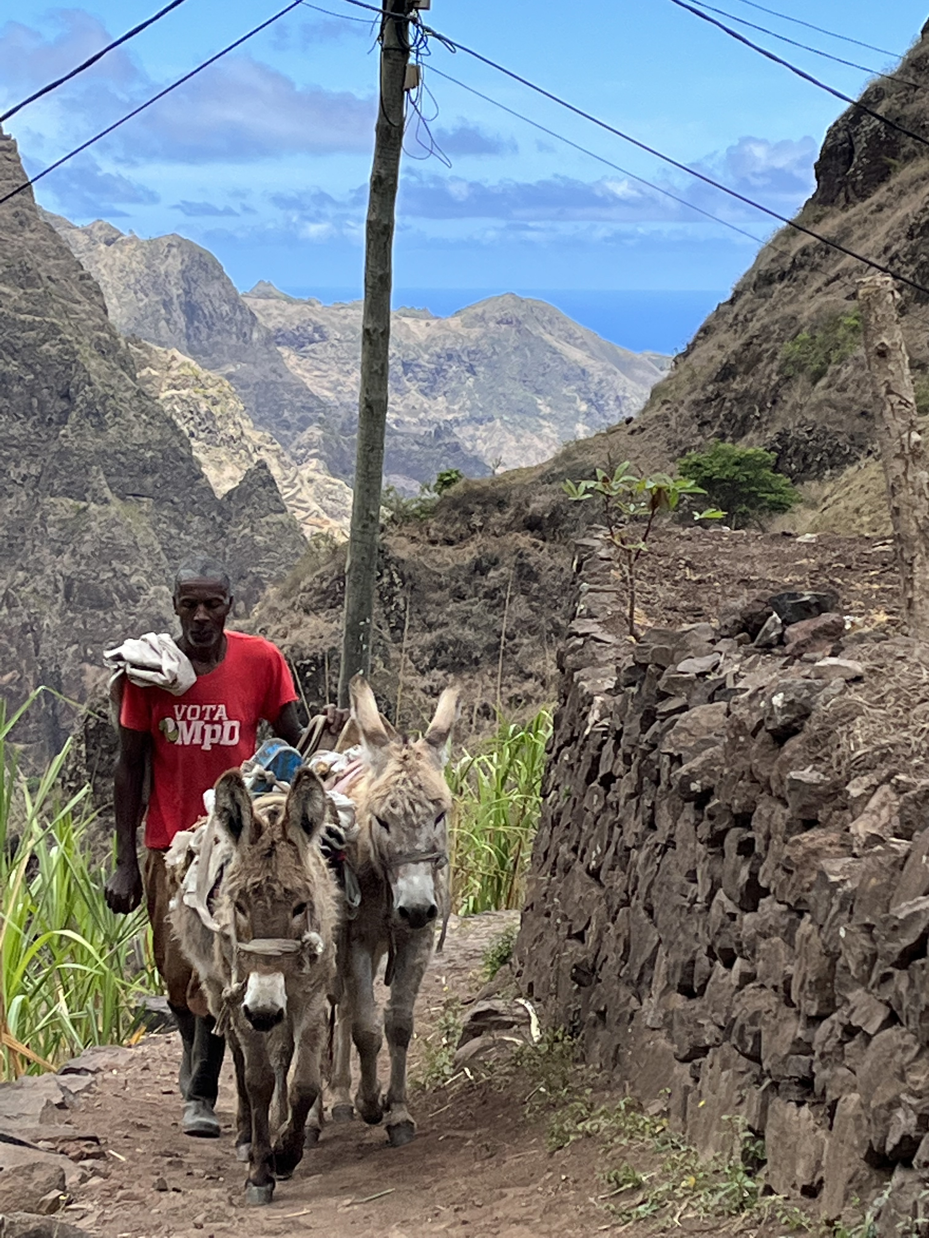
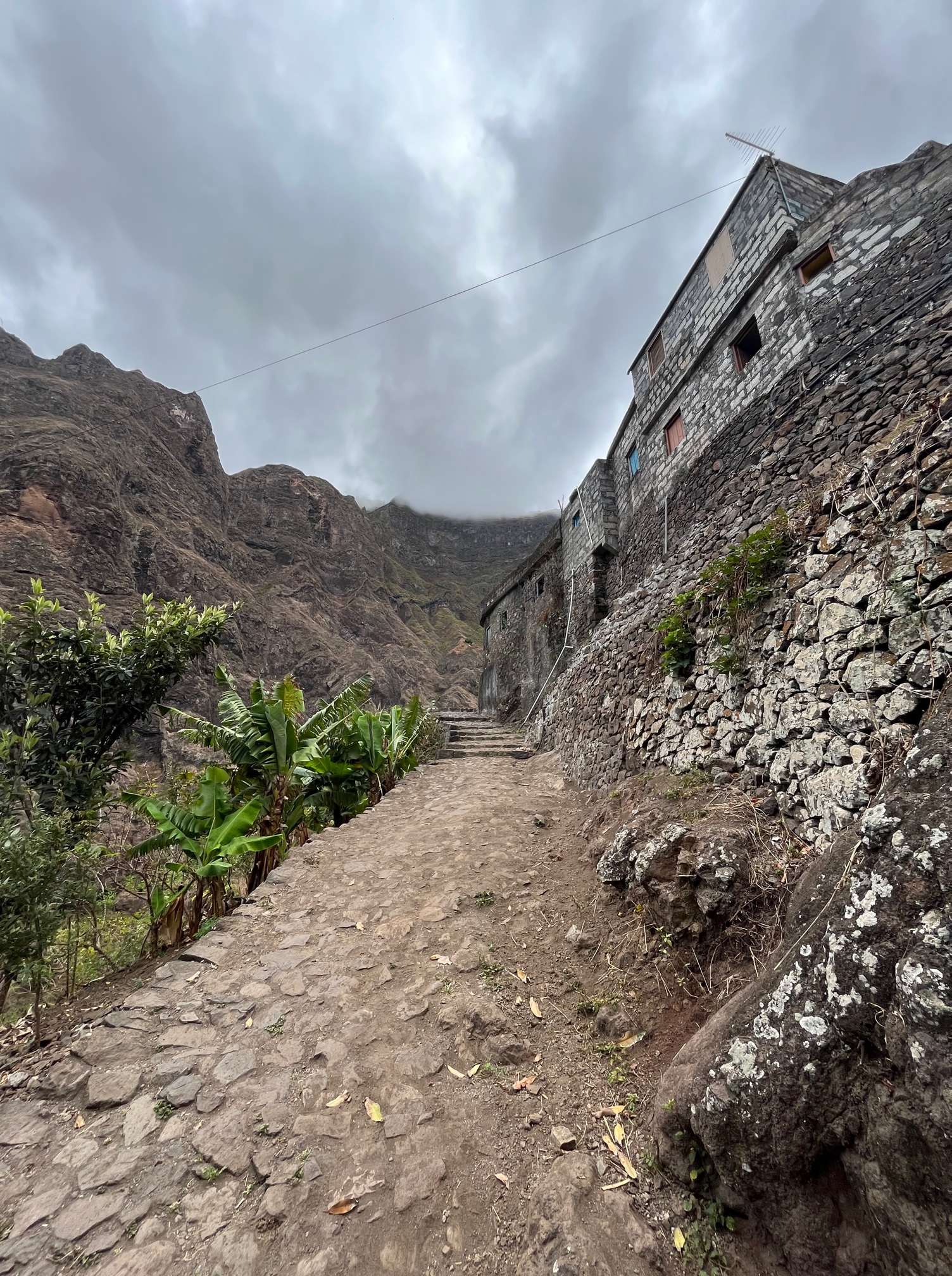
Where the road ends, a cobblestone path snakes up through the terraced fields climbing 2000 feet to the village of Xoxo high in the mountains. This is a strenuous 1.5 hour climb for us but a regular walk for the villagers who go about their daily life. We pass an old woman who is slowly making her way up with the help of a stick, young folks moving farm produce and animal feed to and from their fields and barns. In the afternoon we come across a group of kids returning home from school in the neighboring town, busy chatting and joking with each other – oblivious of the incline.
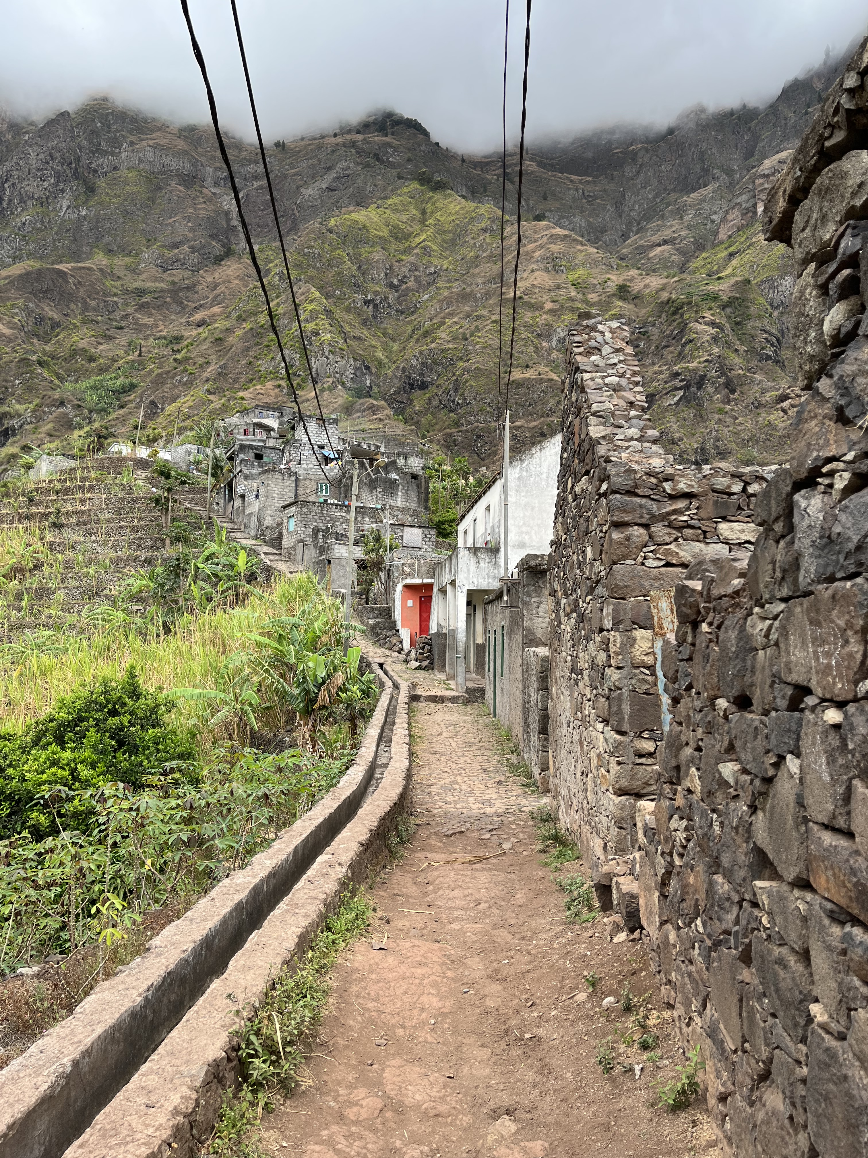
The village is nothing more than a row of houses with narrow alleys in between. One side is the main path and the other side has steps that descend steep slopes to the terraced fields below.
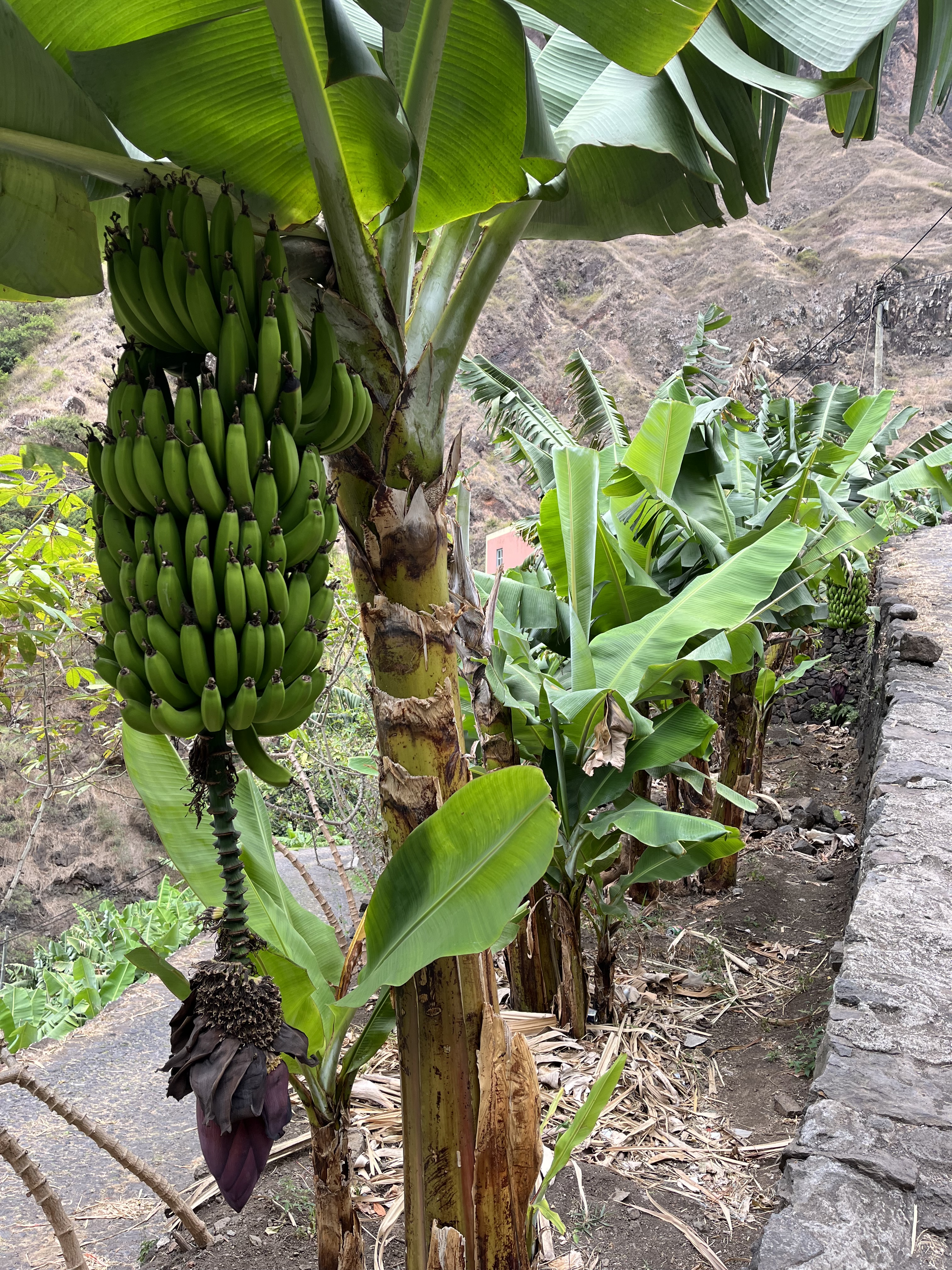
We ask a woman who is cutting a stalk of bananas from her tree, if we can have a few. Without hesitation she cuts a bunch and hands it to us. And when we ask “How much?” she gestures that it is nothing. We insist on paying her. She accepts with a “Obrigada” and a big smile. Tired and weary we sit by the side of the path and eat those delicious ripe bananas.
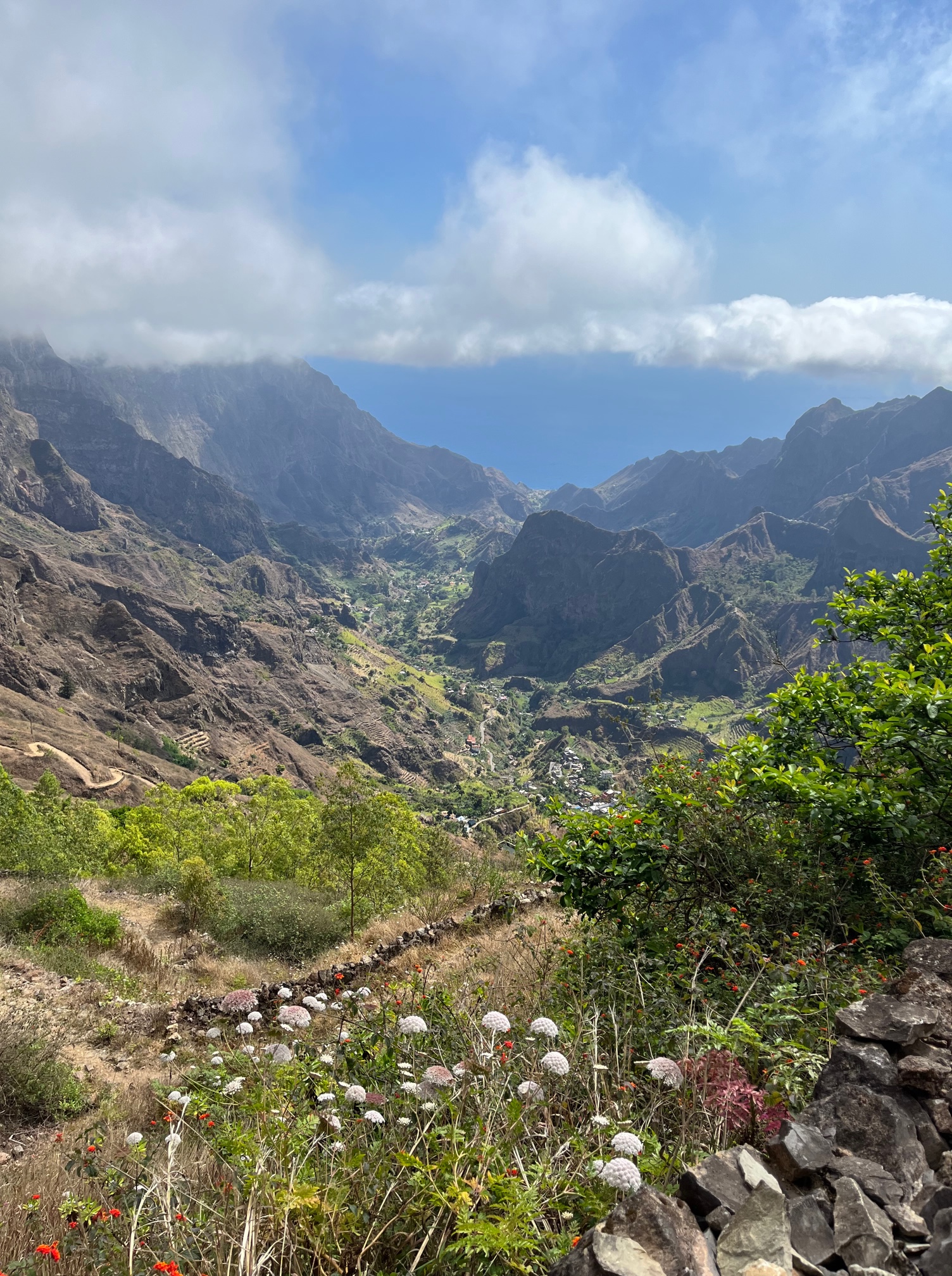
Hiking Cova Crater to Paul Valley
On another trip to Santo Antão, a taxi driver drops us off at the trail head to the Cova Crater and motions us to start walking. It is an easy descent into the crater floor which is full of corn and bean fields. We traverse along the side of the crater and start climbing again towards the opposite rim. As we climb, we see clouds flowing into the crater. These moisture laden clouds are key to the traditional non-irrigational agriculture that the villagers practice.
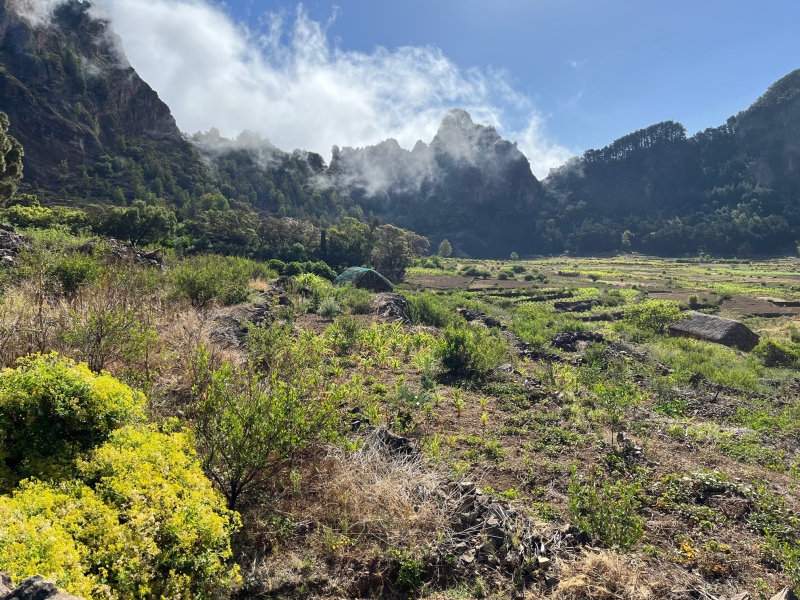
View from the fields in the crater
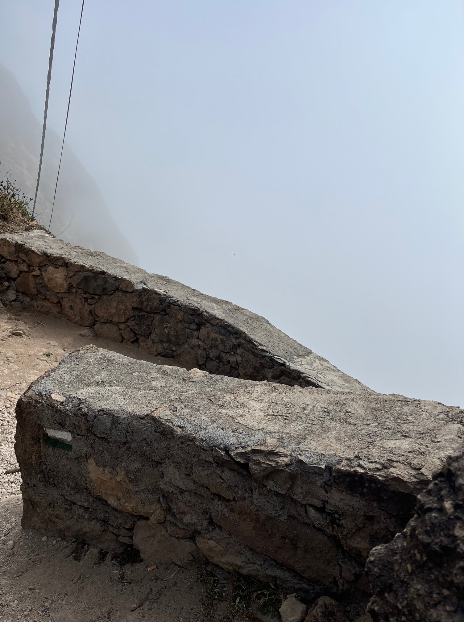
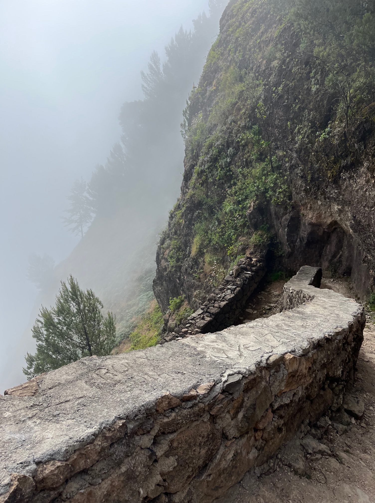
The rim is a thin ridge that separates the crater from the valley on the other side. The trails cuts into the ridge and seems to disappear into the clouds on the other side. A long series of switchbacks cling to the steep slopes.
Cross the rim to the other side and you are in the clouds!
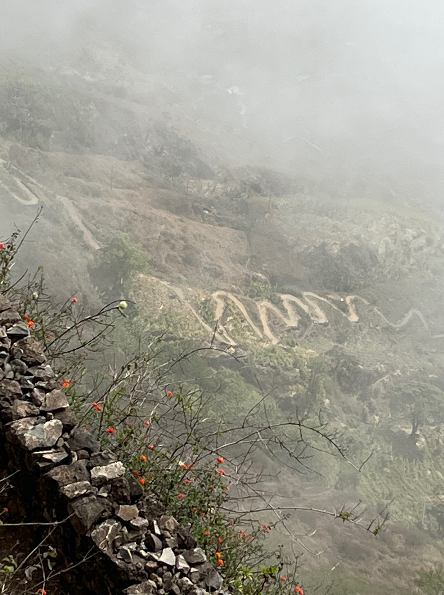
Our descent is slow and once we are half-way down, the clouds start to thin and we can see many more switchbacks that lead to a village in the valley.
And just like that we are below the clouds with an incredible view of Paul valley that extends all the way to the coast.
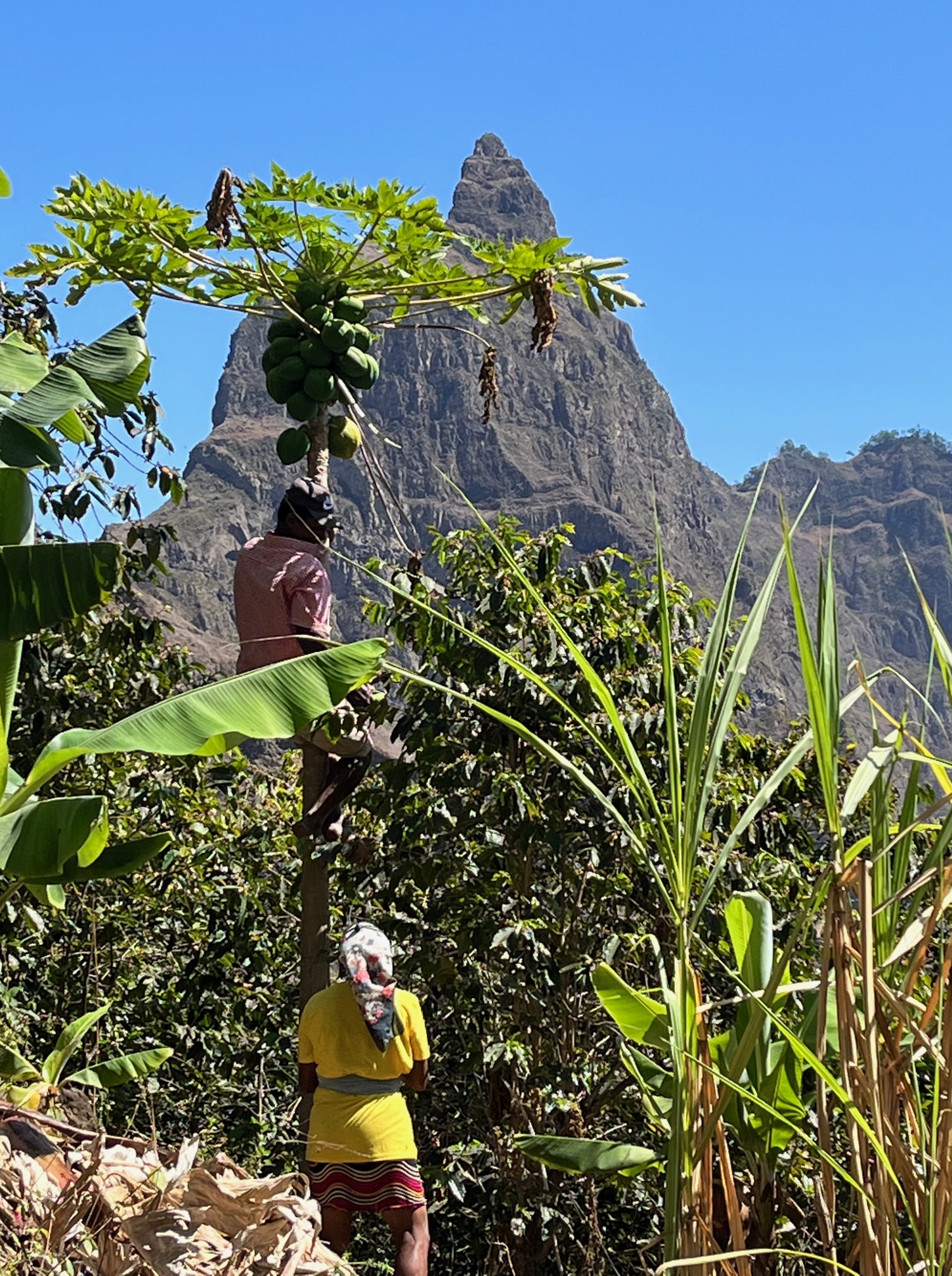
Harvesting papayas
We meet a couple harvesting papayas in their fields. In spite of the fact that I speak none of their languages, they show me their coffee plants and fruit trees including mango and bananas. Most of them grow sugarcane as well, which is typically used to make Grogue – a local liquor. In Spanish the man explains to Swagata that during the rainy season, the entire hillside is lush and “Muy Bonito”.
Every house in the village has million dollar views!
Once we reach the village of Cabo da Ribiera in the valley, we take a Aluguer (shared taxi) to Ribeira Grande, the nearest town on the coast. We plan to stay the night here before taking the ferry back the next morning.
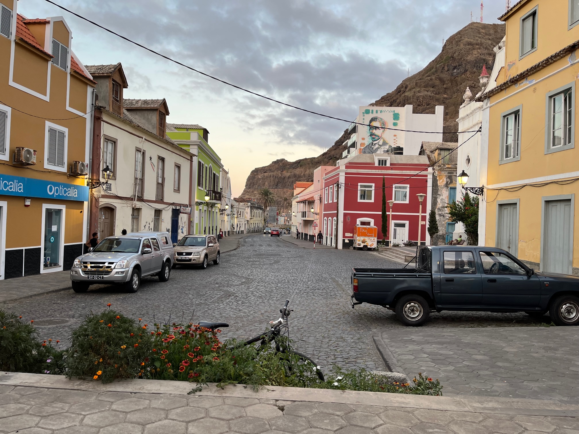
Quiet evening in the town square in Ribiera Grande
Santo Antão is a stunning island with landscapes that span extremes – it’s definitely a treasure. It is not easy to get to and road access is limited. It lacks white sand beaches and large resorts, western style restaurants and cafes – and therefore does not attract the typical western vacationer. In fact you see very few tourists. That said, it is popular with hikers (almost entirely French) and those who love getting close to nature. As it stands, it is relatively untouched and a remarkably beautiful place!

Wow! Unbelievably gorgeous! Thank you for sharing…such beauty!!!!! ❤
LikeLiked by 1 person
Thank you for reading!
LikeLike